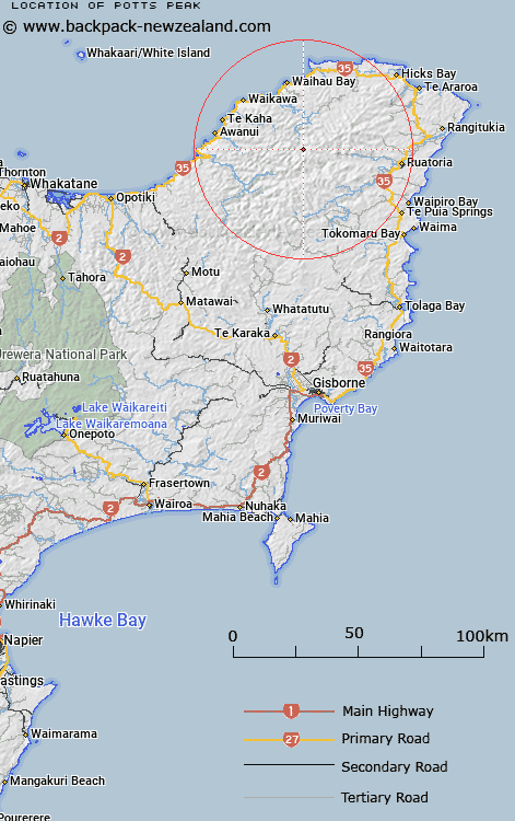
Map showing location of Potts Peak
LINZ description: Peak approximately 750m west-north-west of Trig. 1328 (Geodetic Code A5TA), in the Raukumara Range. Raukumara West Survey District.
Latitude: -37.841967
Longitude: 177.964496
Northing: 5800089.3
Easting: 2036939.3
Land District: Gisborne
Feat Type: Hill
Latitude: -37.841967
Longitude: 177.964496
Northing: 5800089.3
Easting: 2036939.3
Land District: Gisborne
Feat Type: Hill

Scroll down to see a more detailed road map and below that a topographical map showing the location of Potts Peak. The road map has been supplied by openstreetmap and the topographical map of Potts Peak has been supplied by Land Information New Zealand (LINZ).
Yes you can use the top static map for you school/university project or personal website with a link back. Contact me for any commercial use.
[ A ] [ B ] [ C ] [ D ] [ E ] [ F ] [ G ] [ H ] [ I ] [ J ] [ K ] [ L ] [ M ] [ N ] [ O ] [ P ] [ Q ] [ R ] [ S ] [ T ] [ U ] [ V ] [ W ] [ X ] [ Y ] [ Z ]