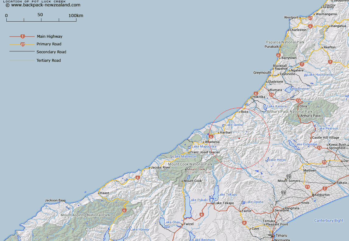
Map showing location of Pot Luck Creek


LINZ description: Minor tributary of Wanganui River 1.35km west of Devastation Creek, first tributary downstream on left bank from Frame Pack Creek. Butler Survey District.
Latitude: -43.213036
Longitude: 170.814895
Northing: 5213209.5
Easting: 1422509.5
Land District: Westland
Feat Type: Stream


Scroll down to see a more detailed road map and below that a topographical map showing the location of Pot Luck Creek. The road map has been supplied by openstreetmap and the topographical map of Pot Luck Creek has been supplied by Land Information New Zealand (LINZ).

Yes you can use the top static map for you school/university project or personal website with a link back. Contact me for any commercial use.

Pot Luck Creek Map New Zealand


New Zealand places in our database
[ A ] [ B ] [ C ] [ D ] [ E ] [ F ] [ G ] [ H ] [ I ] [ J ] [ K ] [ L ] [ M ] [ N ] [ O ] [ P ] [ Q ] [ R ] [ S ] [ T ] [ U ] [ V ] [ W ] [ X ] [ Y ] [ Z ]


Closest 20 Streams to Pot Luck Creek

Devastation Creek ( 1.38km )   Galway Creek ( 2.03km )   Noisy Torrent ( 2.28km )   Frame Pack Creek ( 2.39km )   Caper Torrent ( 2.41km )   Spar Creek ( 2.59km )   Crevice Creek ( 3.29km )   Smyth River ( 3.48km )   Bradshaw Creek ( 3.66km )   Jumping Creek ( 3.89km )   Vane Stream ( 3.93km )   Evans River ( 4.02km )   Midnight Torrent ( 4.1km )   Rifle Torrent ( 4.28km )   Headwater Creek ( 4.35km )   Benighted Creek ( 4.88km )   Froth Creek ( 5.06km )   Even Flow Stream ( 5.06km )   Lambert River ( 5.44km )   Swift Water ( 5.6km )   Fury Torrent ( 5.68km )   Canary Creek ( 5.91km )   County Stream ( 6.25km )   Ally Trickle ( 6.3km )   Lord River ( 6.58km )   Peter Creek ( 6.81km )   Bloomfield Creek ( 6.88km )   Blomfield Creek ( 6.88km )   Vapour Creek ( 6.92km )   Dorothy Creek ( 7.12km )   Moonbeam Torrent ( 7.58km )   Alexander Creek ( 7.81km )   Mad Water ( 7.91km )   O'Reilly Creek ( 8.15km )   Whirling Water ( 8.32km )   Glamour Torrent ( 8.48km )   Steep Creek ( 8.72km )   Isobel Creek ( 8.82km )   Adams River ( 8.87km )   Bartrum Creek ( 8.89km )