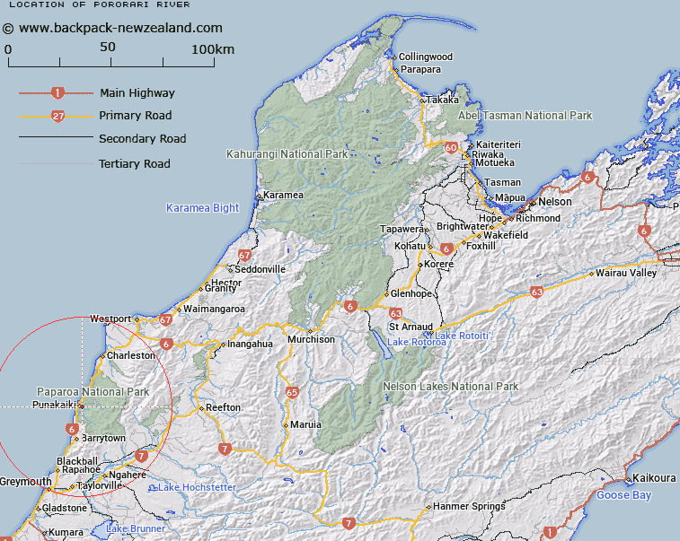
Map showing location of Pororari River
LINZ description: River rising in the Paparoa Range, between Mount Pecksniff and White Knight Peak, on their north-western slopes, flowing North-westward, and entering the Tasman Sea approximately 1km North of Punakaiki locality. Waiwhero, Brighton and Punakaiki Survey Districts.
Latitude: -42.111513
Longitude: 171.349155
Northing: 5336523.8
Easting: 1463518
Land District: Nelson, Westland
Feat Type: Stream
Latitude: -42.111513
Longitude: 171.349155
Northing: 5336523.8
Easting: 1463518
Land District: Nelson, Westland
Feat Type: Stream

Scroll down to see a more detailed road map and below that a topographical map showing the location of Pororari River. The road map has been supplied by openstreetmap and the topographical map of Pororari River has been supplied by Land Information New Zealand (LINZ).
Yes you can use the top static map for you school/university project or personal website with a link back. Contact me for any commercial use.
[ A ] [ B ] [ C ] [ D ] [ E ] [ F ] [ G ] [ H ] [ I ] [ J ] [ K ] [ L ] [ M ] [ N ] [ O ] [ P ] [ Q ] [ R ] [ S ] [ T ] [ U ] [ V ] [ W ] [ X ] [ Y ] [ Z ]