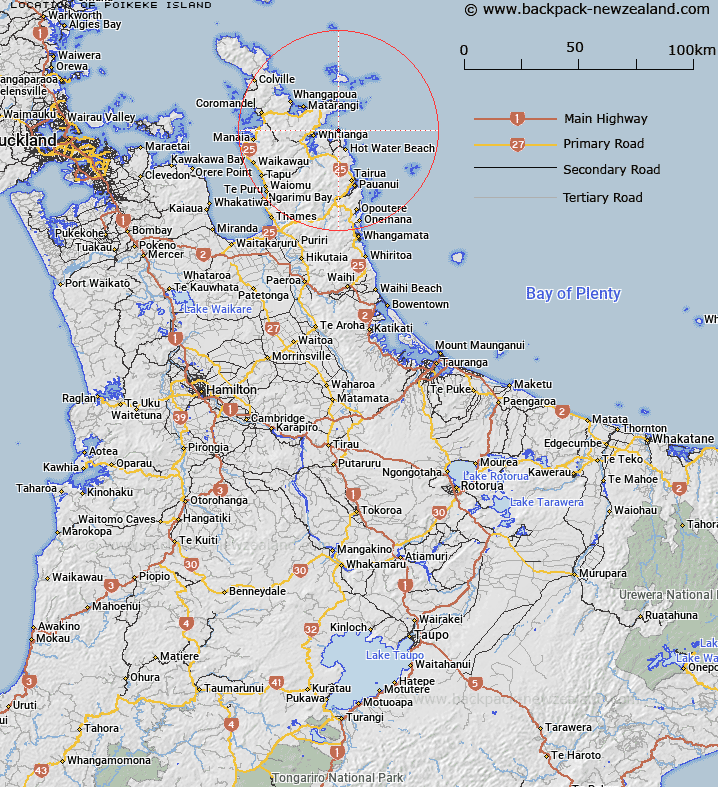
Map showing location of Poikeke Island


LINZ description: Islet just west of and inshore of Motueka (Pigeon) Island lying easterly of Mercury Bay. Block IX Otama Survey District.
Latitude: -36.820393
Longitude: 175.797243
Northing: 5921400
Easting: 1849500
Land District: South Auckland
Feat Type: Island


Scroll down to see a more detailed road map and below that a topographical map showing the location of Poikeke Island. The road map has been supplied by openstreetmap and the topographical map of Poikeke Island has been supplied by Land Information New Zealand (LINZ).

Yes you can use the top static map for you school/university project or personal website with a link back. Contact me for any commercial use.

Poikeke Island Map New Zealand


New Zealand places in our database
[ A ] [ B ] [ C ] [ D ] [ E ] [ F ] [ G ] [ H ] [ I ] [ J ] [ K ] [ L ] [ M ] [ N ] [ O ] [ P ] [ Q ] [ R ] [ S ] [ T ] [ U ] [ V ] [ W ] [ X ] [ Y ] [ Z ]


Closest 20 Islands to Poikeke Island

Poikeke Island ( 0km )   Motueka Island (Pigeon Island) ( 0.51km )   Moturoa Island (Tower Rock) ( 0.83km )   Waikaranga Island ( 1.89km )   Okorotere Island ( 2.12km )   Mahurangi Island (Goat Island) ( 2.26km )   Te Tio Island ( 2.48km )   Te Karaka Island ( 2.83km )   Motukorure Island (Centre Island) ( 3.17km )   Mahungarape Island (Round Island) ( 5.1km )   The Twins (Motumanga) ( 6.53km )   Lion Rock ( 6.82km )   Motukoranga Island ( 8.65km )   Castle Island ( 9.82km )   Needle Rock ( 10.47km )   Motukoruenga Island ( 10.74km )   Sunk Rock ( 11.82km )   Rabbit Island ( 12.04km )   Ohena Island ( 12.7km )   Ohinau Island ( 12.7km )   Mahinapua Rocks ( 12.95km )   Old Man Rock ( 13.07km )   Waipapa Island ( 13.42km )   Flat Island ( 13.74km )   Ohinauiti Island ( 13.88km )   Little Ohena Island ( 13.88km )   Tokaiti Rock ( 14.08km )   Black Rocks ( 14.92km )   Danger Rocks ( 15.16km )   Whale Rock ( 17.72km )   Korapuki Island ( 18.57km )   Motukaha Island ( 19.94km )   Green Island ( 20.11km )   Pungapunga Island ( 20.65km )   Atiu or Middle Island ( 21.06km )   Middle Island ( 21.06km )   Atiu Island ( 21.06km )   Kawhitu or Stanley Island ( 21.53km )   Stanley Island (Atiu) ( 21.53km )   Shoe Island (Motuhoa) ( 21.57km )