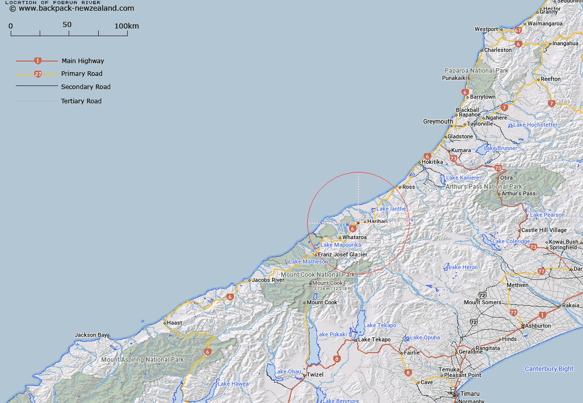
Map showing location of Poerua River


LINZ description: Feature shown on: NZMS260 I34 Edition 1 1994
Latitude: -43.155593
Longitude: 170.502863
Northing: 5218879.5
Easting: 1396972.6
Land District: Westland
Feat Type: Stream


Scroll down to see a more detailed road map and below that a topographical map showing the location of Poerua River. The road map has been supplied by openstreetmap and the topographical map of Poerua River has been supplied by Land Information New Zealand (LINZ).

Yes you can use the top static map for you school/university project or personal website with a link back. Contact me for any commercial use.
Poerua River Map New Zealand


New Zealand places in our database
[ A ] [ B ] [ C ] [ D ] [ E ] [ F ] [ G ] [ H ] [ I ] [ J ] [ K ] [ L ] [ M ] [ N ] [ O ] [ P ] [ Q ] [ R ] [ S ] [ T ] [ U ] [ V ] [ W ] [ X ] [ Y ] [ Z ]


Closest 20 Streams to Poerua River

Minehans Creek ( 0.56km )   Flax Creek ( 2.7km )   Blowhole Creek ( 2.98km )   McCullouchs Creek ( 3.25km )   Sam Creek ( 3.57km )   Ferguson Creek ( 3.88km )   Gee Creek ( 4.49km )   Hercules Creek ( 4.72km )   Ash Creek ( 4.87km )   Saint Georges Creek ( 5.18km )   Dry Creek ( 5.2km )   St Georges Creek ( 5.64km )   Snake Creek ( 5.74km )   Tom Creek ( 5.77km )   Uncle Toms Creek ( 5.86km )   Gunn Creek ( 6.11km )   Big Creek ( 6.24km )   Harold Creek ( 7.3km )   Rotokino River ( 7.32km )   Rata Creek ( 7.44km )   Thorpe Creek ( 8.05km )   Wingham Creek ( 8.45km )   McClausland Creek ( 8.6km )   La Fontaine Stream ( 9km )   Berry Creek ( 9.29km )   Pye Creek ( 9.31km )   Hinatua River ( 9.54km )   Wanganui River ( 10.03km )   Vickers Creek ( 10.23km )   Tribute Creek ( 10.68km )   Incense Creek ( 10.86km )   Tarpot Creek ( 10.88km )   Minnow Creek ( 11.23km )   Dry Creek (Little Man River) ( 11.32km )   Hurleys Creek ( 11.38km )   Vine Creek ( 11.57km )   Prattle Stream ( 11.67km )   Whale Creek ( 11.68km )   Evans Creek ( 11.69km )   Ianthe Creek ( 11.89km )