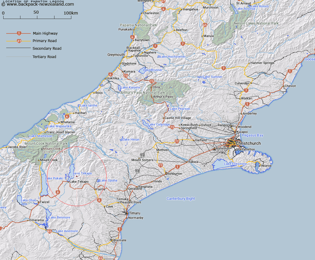
Map showing location of Phantom Lagoon


LINZ description: A small lagoon in the foothills of Two Thumb Range east of Lake Tekapo and north east of Wee McGregor.
Latitude: -43.935321
Longitude: 170.595377
Northing: 5132500
Easting: 1407000
Land District: Canterbury
Feat Type: Lake


Scroll down to see a more detailed road map and below that a topographical map showing the location of Phantom Lagoon. The road map has been supplied by openstreetmap and the topographical map of Phantom Lagoon has been supplied by Land Information New Zealand (LINZ).

Yes you can use the top static map for you school/university project or personal website with a link back. Contact me for any commercial use.

Phantom Lagoon Map New Zealand


New Zealand places in our database
[ A ] [ B ] [ C ] [ D ] [ E ] [ F ] [ G ] [ H ] [ I ] [ J ] [ K ] [ L ] [ M ] [ N ] [ O ] [ P ] [ Q ] [ R ] [ S ] [ T ] [ U ] [ V ] [ W ] [ X ] [ Y ] [ Z ]


Closest 20 Lakes to Phantom Lagoon

Roys Lagoon ( 6.64km )   Lake Tekapo ( 6.88km )   Lake McGregor ( 9.97km )   Trig 'N' Tarn ( 10.13km )   Lake Murray ( 10.7km )   Rapuwai Lagoon ( 11.59km )   Lake Alexandrina ( 11.8km )   Jimmeys Lagoon ( 12.07km )   Stony Tarn ( 13.74km )   Scott Pond ( 13.78km )   Tui Tarn ( 13.81km )   Hartley Tarn ( 13.82km )   Grebe Tarn ( 13.85km )   Sunday Tarn ( 14.46km )   Glenmore Tarns ( 14.66km )   Boundary Tarns ( 15.15km )   Cluster Tarns ( 15.41km )   Forks Lagoon ( 17.11km )   Patersons Ponds ( 18.95km )   Freds Tarn ( 19.23km )   Fred's Tarn ( 19.23km )   Lake Opuha ( 23.23km )   Swan Lagoon ( 23.85km )   Boltons Gully Lagoon ( 27.98km )   The Black Hole ( 28.59km )   Braemar Kettleholes ( 30.98km )   Lake Pukaki ( 34.63km )   Acland Lagoon ( 40.38km )   Tasman Lake ( 42.33km )   Blue Lakes ( 43.76km )   Red Tarns ( 44.92km )   Lake Wardell ( 47.66km )   Hooker Lake ( 48.34km )   Sealy Tarns ( 48.53km )   Lake Poaka ( 49.74km )   Howard Lake ( 51.22km )   Lake Howard ( 51.33km )   Lake Camp ( 51.33km )   Lake Clearwater ( 51.6km )   Tripp Lake ( 51.6km )