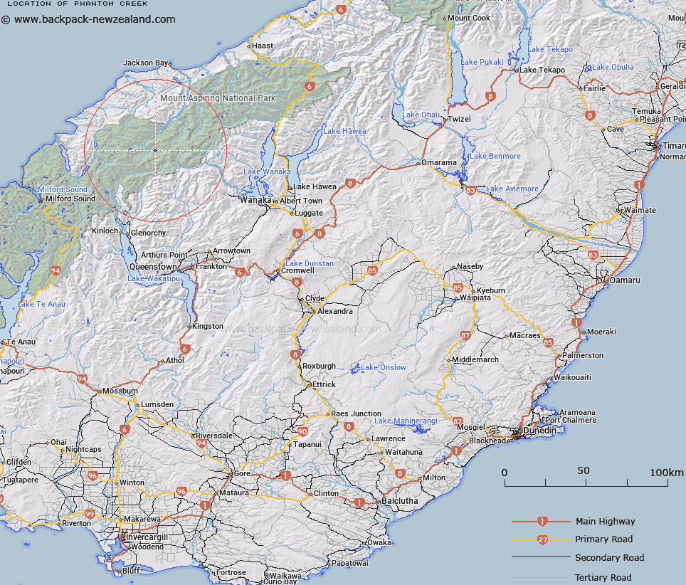
Map showing location of Phantom Creek


LINZ description: Flows into the Arawata River from the region of the Snow-white Glacier
Latitude: -44.417989
Longitude: 168.535782
Northing: 5072000
Easting: 1244600
Land District: Otago
Feat Type: Stream


Scroll down to see a more detailed road map and below that a topographical map showing the location of Phantom Creek. The road map has been supplied by openstreetmap and the topographical map of Phantom Creek has been supplied by Land Information New Zealand (LINZ).

Yes you can use the top static map for you school/university project or personal website with a link back. Contact me for any commercial use.

Phantom Creek Map New Zealand


New Zealand places in our database
[ A ] [ B ] [ C ] [ D ] [ E ] [ F ] [ G ] [ H ] [ I ] [ J ] [ K ] [ L ] [ M ] [ N ] [ O ] [ P ] [ Q ] [ R ] [ S ] [ T ] [ U ] [ V ] [ W ] [ X ] [ Y ] [ Z ]


Closest 20 Streams to Phantom Creek

Stokes Creek ( 1.33km )   Snowball Creek ( 2.19km )   Mercer Stream ( 4.04km )   South Snowball Creek ( 5.25km )   Fez Creek ( 6.4km )   Yashmak Creek ( 7.99km )   The Bascand ( 8.31km )   Topsey Creek ( 8.52km )   Williamson River ( 8.78km )   The Wilson ( 8.82km )   The Purser ( 8.96km )   Ridge Creek ( 9.03km )   Whitbourn River ( 9.15km )   Tornado Creek ( 9.22km )   Response Torrent ( 9.38km )   Liverpool Stream ( 9.68km )   Blue Duck River ( 9.87km )   Pass Creek ( 9.91km )   Ten Hour Gorge Creek ( 9.91km )   Cabin Pass Rapids ( 9.96km )   Halfway Creek ( 10.16km )   Eros Creek ( 10.22km )   The Steward ( 10.26km )   Cat O'Nine Tails ( 10.27km )   The Five Fingers ( 10.27km )   Joe River ( 10.46km )   Rough Creek ( 10.69km )   Collins Creek ( 10.7km )   Cascade Creek ( 10.8km )   Victor Creek ( 11.02km )   The Fireman ( 11.17km )   The Bignell ( 11.18km )   The Binnacle ( 11.79km )   Slate Creek ( 12.2km )   The Funnel ( 12.47km )   Matukituki River West Branch ( 12.62km )   The Grease Pot ( 12.94km )   The Stoker ( 13.03km )   Pass Burn ( 13.22km )   Retreat Creek ( 13.45km )