Map showing location of Paparoa Range


LINZ description: Feature shown on: NZMS260 K29 Edition 2 1994; Infomap 346-02 Te Wai Pounamu Edition 1 1995
Latitude: -42.143293
Longitude: 171.517416
Northing: 5333250.2
Easting: 1477490.4
Land District: Nelson, Westland
Feat Type: Range


Scroll down to see a more detailed road map and below that a topographical map showing the location of Paparoa Range. The road map has been supplied by openstreetmap and the topographical map of Paparoa Range has been supplied by Land Information New Zealand (LINZ).

Yes you can use the top static map for you school/university project or personal website with a link back. Contact me for any commercial use.
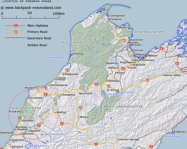
Paparoa Range Map New Zealand


New Zealand places in our database
[ A ] [ B ] [ C ] [ D ] [ E ] [ F ] [ G ] [ H ] [ I ] [ J ] [ K ] [ L ] [ M ] [ N ] [ O ] [ P ] [ Q ] [ R ] [ S ] [ T ] [ U ] [ V ] [ W ] [ X ] [ Y ] [ Z ]


Closest 20 Ranges to Paparoa Range

Paparoa Range ( 0km )   Three Sisters ( 18.07km )   Rapahoe Range (Twelve Apostles Range) ( 38.23km )   Rapahoe Range ( 38.34km )   Twelve Apostles Range ( 38.34km )   Kaiata Range ( 45.48km )   Mount William Range ( 47.55km )   Victoria Range ( 49.51km )   Brunner Range ( 53.48km )   Hohonu Peaks ( 58.78km )   Alexander Range ( 61.83km )   Hohonu Range ( 62.68km )   Kaimata Range ( 65.22km )   The Dreadnought ( 65.9km )   Bald Range ( 69.41km )   The Nelson Tops ( 72.55km )   Kelly Range ( 72.62km )   Griffin Range ( 73.23km )   Lyell Range ( 73.41km )   Freyberg Range ( 73.51km )   Glasgow Range ( 73.75km )   Humphreys Gully Range ( 74.58km )   Tara Tama Range ( 75.18km )   Doubtful Range ( 75.24km )   Blue Spur Range ( 76.23km )   Sylvia Tops ( 77.37km )   Crawford Range ( 77.61km )   Aicken Range ( 77.63km )   Dampier Range ( 78.93km )   McArthur Range ( 79.04km )   Snow Cup Range ( 79.47km )   Spenser Range ( 79.84km )   Opera Range ( 81.65km )   Libretto Range ( 82.25km )   Campbell Range ( 83.73km )   Newton Range ( 84.01km )   Studleigh Range ( 85.4km )   Ella Range ( 87.15km )   McLaurin Range ( 87.56km )   Maclaurin Ridge ( 87.56km )