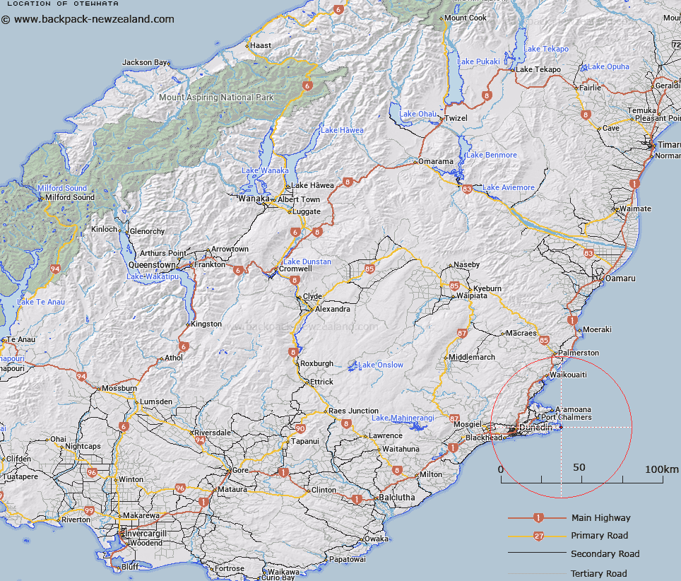
Map showing location of Otewhata


LINZ description: Point on eastern coast of Otago Peninsula, southern headland of Papanui Beach.
Latitude: -45.868519
Longitude: 170.750433
Northing: 4918100
Easting: 1425400
Land District: Otago
Feat Type: Point


Scroll down to see a more detailed road map and below that a topographical map showing the location of Otewhata. The road map has been supplied by openstreetmap and the topographical map of Otewhata has been supplied by Land Information New Zealand (LINZ).

Yes you can use the top static map for you school/university project or personal website with a link back. Contact me for any commercial use.

Otewhata Map New Zealand


New Zealand places in our database
[ A ] [ B ] [ C ] [ D ] [ E ] [ F ] [ G ] [ H ] [ I ] [ J ] [ K ] [ L ] [ M ] [ N ] [ O ] [ P ] [ Q ] [ R ] [ S ] [ T ] [ U ] [ V ] [ W ] [ X ] [ Y ] [ Z ]


Closest 20 Points to Otewhata

Ohinepuha ( 1.42km )   Cape Saunders ( 1.43km )   Matakitaki Point ( 2.19km )   Titikoraki ( 2.51km )   Te Whakarekaiwi ( 5.99km )   Pipikaretu Point ( 7.29km )   Harakeke Point ( 7.81km )   O te Ukuuku Tuku ( 7.81km )   Te Pari o Te Mataahua ( 8.38km )   Rerewahine Point ( 9.02km )   Quarantine Point ( 9.65km )   Harrington Point ( 9.71km )   Harington Point ( 9.71km )   Seal Point ( 9.83km )   Yellow Head ( 10.12km )   Taiaroa Head ( 10.77km )   Otafelo Point ( 10.81km )   Taylor Point ( 10.83km )   Tayler Point ( 10.83km )   Pulling Point ( 11.02km )   Acheron Point ( 11.38km )   Grassy Point ( 11.56km )   Rocky Point ( 11.87km )   Goldie Point ( 11.93km )   Kilgours Point ( 12.29km )   Curles Point ( 13.01km )   Heyward Point ( 13.28km )   Purehurehu Point ( 13.64km )   Pilot Point ( 13.68km )   Maori Head ( 14.84km )   Black Jacks Point ( 16.45km )   Potato Point ( 16.82km )   Lawyers Head ( 17.32km )   Burns Point ( 17.39km )   Doctors Point ( 19.14km )   Brinns Point ( 23.25km )   Green Point ( 23.71km )   Black Head ( 25.61km )   Cornish Head ( 28.15km )   Bobbys Head ( 37.68km )