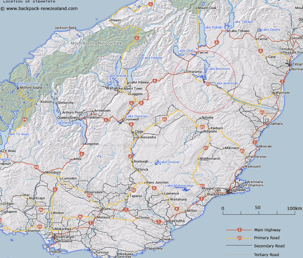
Map showing location of Otematata


LINZ description: Construction town for Benmore Hydro-electirc scheme. Near confluence of Waitaki and Otematata Rivers. Gala Survey District.
Latitude: -44.604282
Longitude: 170.191995
Northing: 5057171.5
Easting: 1377166.8
Land District: Otago
Feat Type: Town


Scroll down to see a more detailed road map and below that a topographical map showing the location of Otematata. The road map has been supplied by openstreetmap and the topographical map of Otematata has been supplied by Land Information New Zealand (LINZ).

Yes you can use the top static map for you school/university project or personal website with a link back. Contact me for any commercial use.

Otematata Map New Zealand


New Zealand places in our database
[ A ] [ B ] [ C ] [ D ] [ E ] [ F ] [ G ] [ H ] [ I ] [ J ] [ K ] [ L ] [ M ] [ N ] [ O ] [ P ] [ Q ] [ R ] [ S ] [ T ] [ U ] [ V ] [ W ] [ X ] [ Y ] [ Z ]


Closest 20 Towns to Otematata

Sailors Cutting ( 11.16km )   Slip Panels Corner ( 27.69km )   Twizel ( 39.26km )   Lake Ohau Alpine Village ( 46.04km )   Drybread Diggings ( 61.72km )   Garibaldi Diggings ( 66.3km )   Tinkers Diggings ( 67.1km )   Tekapo Military Camp ( 68.91km )   Waimate ( 69.12km )   German Hill Diggings ( 69.81km )   Devonshire Diggings ( 71.36km )   The Pines ( 72.2km )   Hamilton Diggings ( 72.29km )   The Forks ( 78.2km )   Rocky Point ( 79.7km )   Oamaru ( 82.39km )   Lookout Point ( 83.29km )   Stratheona Huts ( 84.56km )   Wanaka ( 84.68km )   Pembroke ( 84.68km )   The Criffel Diggings ( 85.01km )   Butlers Crossing ( 86.11km )   The Bend ( 86.37km )   Timaru ( 87.37km )   Golden Point ( 87.81km )   Quartz Reef Point ( 88.17km )   Borrell Creek Cutting ( 88.69km )   Dead Mans Point ( 90.58km )   Goats Camp ( 95.31km )   Hooker Corner ( 96.23km )   Serpentine Diggings ( 96.3km )   Aoraki/Mount Cook ( 96.94km )   Mount Cook ( 96.94km )   Shellbacks Beach ( 97.88km )   The Island ( 99.44km )   Pylep Diggings ( 100.57km )   Kerin Forks ( 100.91km )   The Neck ( 101.74km )   Davis Bend ( 102.48km )   The Cove ( 104.99km )