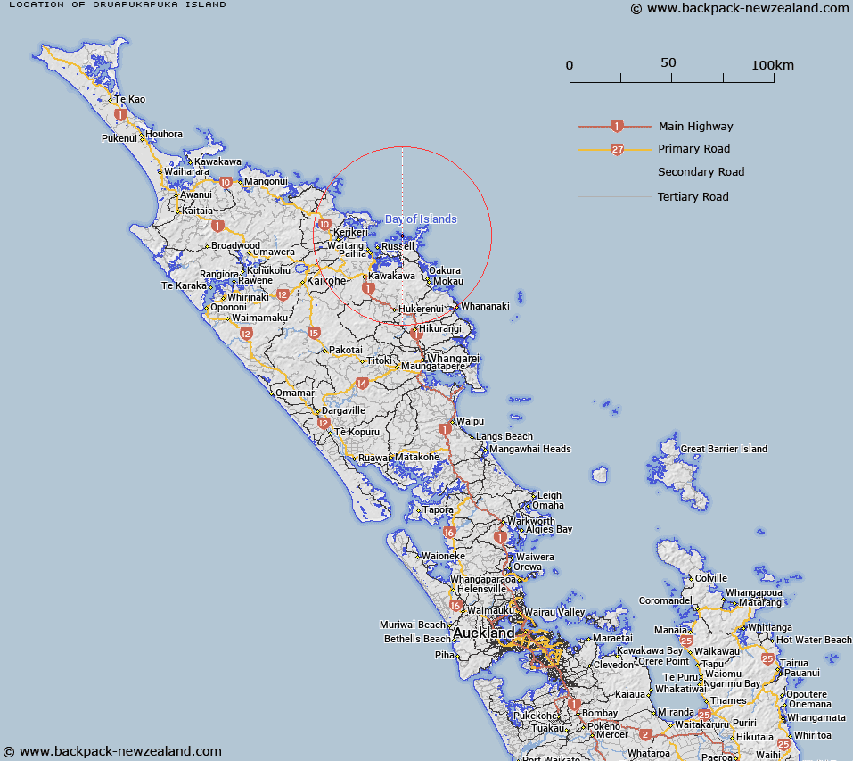
Map showing location of Oruapukapuka Island


LINZ description: Urupukapuka is the largest of seven islands in the eastern Bay of Islands on Northland's east coast.
Latitude: -35.213529
Longitude: 174.23176
Northing: 6102582.1
Easting: 1712110.3
Land District: North Auckland
Feat Type: Island


Scroll down to see a more detailed road map and below that a topographical map showing the location of Oruapukapuka Island. The road map has been supplied by openstreetmap and the topographical map of Oruapukapuka Island has been supplied by Land Information New Zealand (LINZ).

Yes you can use the top static map for you school/university project or personal website with a link back. Contact me for any commercial use.

Oruapukapuka Island Map New Zealand


New Zealand places in our database
[ A ] [ B ] [ C ] [ D ] [ E ] [ F ] [ G ] [ H ] [ I ] [ J ] [ K ] [ L ] [ M ] [ N ] [ O ] [ P ] [ Q ] [ R ] [ S ] [ T ] [ U ] [ V ] [ W ] [ X ] [ Y ] [ Z ]


Closest 20 Islands to Oruapukapuka Island

Uruapukapuka Island ( 0.43km )   Te Ao Island ( 1.75km )   Round Island ( 1.79km )   Waewaetorea Island ( 1.81km )   Otawaki Island ( 1.81km )   Hat Island ( 1.88km )   Poroporo Island ( 1.93km )   Mahenotiti Island ( 2.15km )   Ngatokaparangi Islands ( 2.32km )   Okahu Island ( 2.54km )   Motukiekie Island ( 2.7km )   Tawiriwiri Island ( 2.76km )   Motungarara Island ( 2.77km )   Moturahurahu Island ( 3.48km )   Pakatahi Island ( 3.52km )   Kuiamokimoki Island ( 3.56km )   Moturua Island ( 3.9km )   Motutara Island ( 4.11km )   Moturua Island ( 4.48km )   Motuoi Island ( 4.59km )   Rangiatea Island ( 4.77km )   Te Miko Reef ( 4.84km )   Motuwheteke Island ( 5.35km )   Motukauri Island ( 5.87km )   Putahataha Island ( 6km )   Te Waha Island ( 6.14km )   Robinsons Island ( 6.28km )   Motuarohia Island ( 6.28km )   Roberton Island ( 6.28km )   Motukorari Island ( 7.57km )   Flat Rock ( 7.98km )   Net Rock ( 8.12km )   Mahenotapuku ( 8.71km )   Pillar Rock ( 9.5km )   Waewiri Island ( 10.02km )   Waiwiri Island ( 10.02km )   Waiwiri Rock ( 10.27km )   Otuwhanga Island ( 10.42km )   Battleship Rock ( 10.71km )   Black Rocks ( 10.87km )