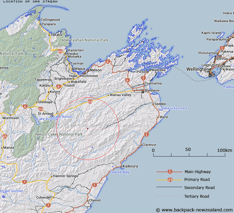
Map showing location of Orr Stream


LINZ description: East flowing tributary at the northern end of Acheron River.
Latitude: -41.96116
Longitude: 173.275167
Northing: 5354499.5
Easting: 1622802.6
Land District: Marlborough
Feat Type: Stream


Scroll down to see a more detailed road map and below that a topographical map showing the location of Orr Stream. The road map has been supplied by openstreetmap and the topographical map of Orr Stream has been supplied by Land Information New Zealand (LINZ).

Yes you can use the top static map for you school/university project or personal website with a link back. Contact me for any commercial use.

Orr Stream Map New Zealand


New Zealand places in our database
[ A ] [ B ] [ C ] [ D ] [ E ] [ F ] [ G ] [ H ] [ I ] [ J ] [ K ] [ L ] [ M ] [ N ] [ O ] [ P ] [ Q ] [ R ] [ S ] [ T ] [ U ] [ V ] [ W ] [ X ] [ Y ] [ Z ]


Closest 20 Streams to Orr Stream

Wildsheep Stream ( 6.89km )   Kennet River ( 8.16km )   Waihopai Saddle Stream ( 8.17km )   Awatere-iti Stream ( 8.26km )   Oyster Stream ( 8.66km )   Blue Mountain Stream ( 9.2km )   Cow Stream ( 9.74km )   Waterfall Stream ( 9.94km )   Gordon Stream ( 10.03km )   Munroe Stream ( 10.6km )   Langridge Stream ( 11.37km )   Team Stream ( 11.8km )   Glazebrook Stream ( 11.82km )   Cat Stream ( 11.86km )   Noisy Stream ( 12.2km )   Smokey Stream ( 12.4km )   Molesworth Stream ( 12.52km )   Ward Stream ( 12.59km )   Weka Brook ( 12.7km )   Leatham River ( 13.11km )   Barber Stream ( 13.12km )   Spray River ( 13.36km )   Dane River ( 13.37km )   Hut Stream ( 13.44km )   Castle River ( 13.57km )   Spaniard Stream ( 13.66km )   Flat Stream ( 13.73km )   Bobs Stream ( 13.92km )   Saxton River ( 14.33km )   Acheron River ( 14.54km )   Hot Rock Stream ( 14.9km )   Whip Stream ( 15.04km )   Pinnacle Stream ( 15.09km )   Krushen Stream ( 15.16km )   Weka Stream ( 15.67km )   Little Castle Stream ( 15.82km )   Bouldery Stream ( 16.05km )   Cave Stream ( 16.39km )   Enchanted Stream ( 16.4km )   Little Cave Stream ( 16.51km )