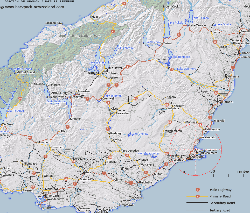
Map showing location of Orokonui Nature Reserve


LINZ description: S.35 NZGB Act 2008 validation
Latitude: -45.769042
Longitude: 170.594956
Northing: 4928800
Easting: 1413000
Land District: Otago
Feat Type: Nature Reserve


Scroll down to see a more detailed road map and below that a topographical map showing the location of Orokonui Nature Reserve. The road map has been supplied by openstreetmap and the topographical map of Orokonui Nature Reserve has been supplied by Land Information New Zealand (LINZ).

Yes you can use the top static map for you school/university project or personal website with a link back. Contact me for any commercial use.
Orokonui Nature Reserve Map New Zealand


New Zealand places in our database
[ A ] [ B ] [ C ] [ D ] [ E ] [ F ] [ G ] [ H ] [ I ] [ J ] [ K ] [ L ] [ M ] [ N ] [ O ] [ P ] [ Q ] [ R ] [ S ] [ T ] [ U ] [ V ] [ W ] [ X ] [ Y ] [ Z ]


Closest 20 Nature Reserves to Orokonui Nature Reserve

Taiaroa Head Nature Reserve ( 10.18km )   Wharekakahu Island Nature Reserve ( 15.43km )   Green Island Nature Reserve ( 26km )   Deighton Creek Nature Reserve ( 36.48km )   Cromwell Chafer Beetle Nature Reserve ( 135.59km )   Mokoreta Nature Reserve ( 137.61km )   Whero Rock Nature Reserve ( 223.25km )   Maori Lakes Nature Reserve ( 248.58km )   Whenua Hou Nature Reserve ( 253.73km )   Lake Heron Nature Reserve ( 259.35km )   Dan Rogers Nature Reserve ( 281.94km )   Waitangiroto Nature Reserve ( 291.75km )   Lance McCaskill Nature Reserve ( 296.67km )   Motunau Island Nature Reserve ( 359.82km )   Te Ara T?iko Nature Reserve ( 408.14km )   Punakaiki Nature Reserve ( 408.5km )   No Mans Island ( 540.1km )   Titi Island Nature Reserve ( 607.37km )   Chetwode Island Nature Reserve ( 610.63km )   Farewell Spit Nature Reserve ( 610.77km )   Takapourewa Nature Reserve ( 630.19km )   Kapiti Island Nature Reserve ( 647.68km )   Fern Bird Bush Nature Reserve ( 850.8km )   Cape Kidnappers Nature Reserve ( 862.93km )   Grand Canyon Nature Reserve ( 885.05km )   Huramua Nature Reserve ( 934.5km )   Motuotu Island Nature Reserve ( 1017.8km )   Tuku Nature Reserve ( 1023.84km )   Mangere Island Nature Reserve ( 1042.64km )   Rangatira Nature Reserve ( 1049.68km )   Aldermen Islands (Ruamaahu) Nature Reserve ( 1080.61km )   Kawhitu Island (Stanley) Nature Reserve ( 1106.75km )   Double Island (Moturehu) Nature Reserve ( 1109.03km )   Repanga (Cuvier) Island Nature Reserve ( 1124.08km )   Little Barrier Island Nature Reserve ( 1128.2km )   Te Hauturu-o-Toi / Little Barrier Island Nature Reserve ( 1128.2km )   Hen & Chicken Islands Nature Reserve ( 1147.52km )   Bream Islands Nature Reserve ( 1153.95km )   Mokohinau Islands Nature Reserve ( 1157.35km )   Poor Knights Islands Nature Reserve ( 1197.07km )