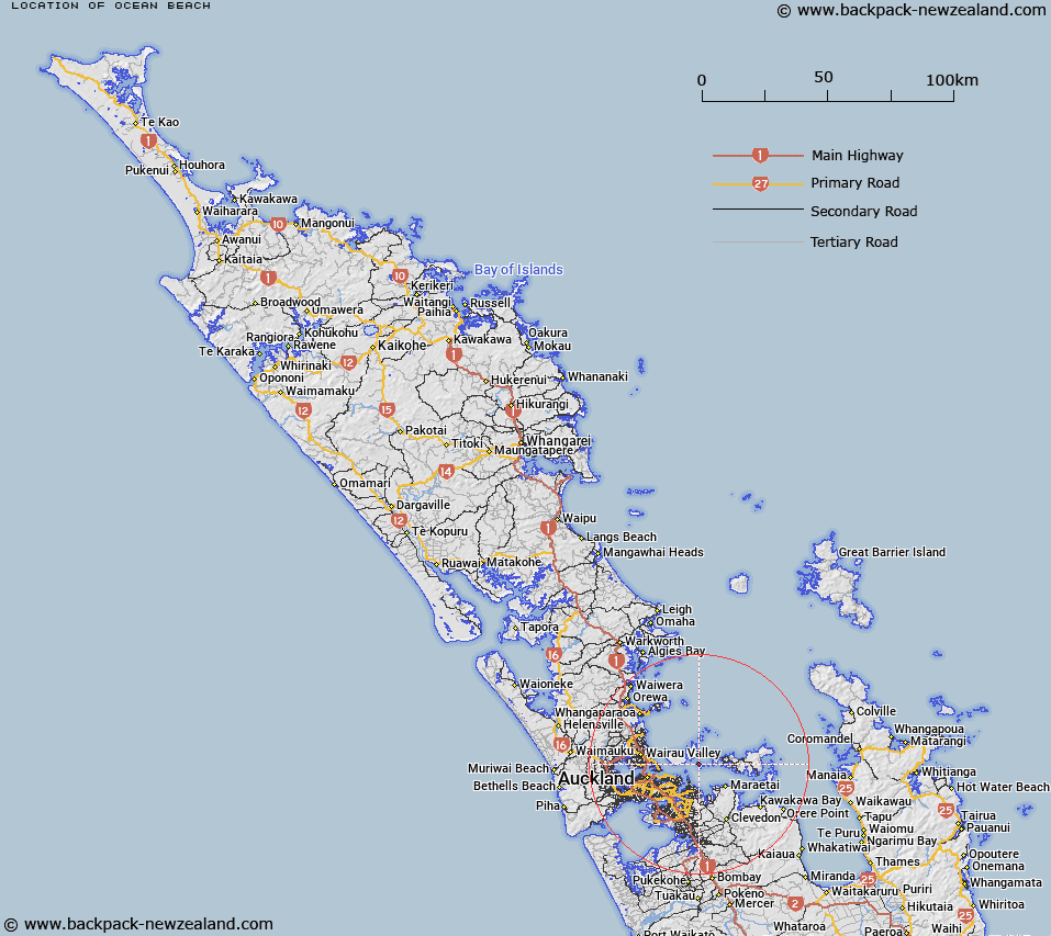
Map showing location of Ocean Beach


LINZ description: Feature shown on: NZMS260 R11
Latitude: -36.805306
Longitude: 174.942139
Northing: 5924965.8
Easting: 1773252.9
Land District: North Auckland
Feat Type: Beach


Scroll down to see a more detailed road map and below that a topographical map showing the location of Ocean Beach. The road map has been supplied by openstreetmap and the topographical map of Ocean Beach has been supplied by Land Information New Zealand (LINZ).

Yes you can use the top static map for you school/university project or personal website with a link back. Contact me for any commercial use.
Ocean Beach Map New Zealand


New Zealand places in our database
[ A ] [ B ] [ C ] [ D ] [ E ] [ F ] [ G ] [ H ] [ I ] [ J ] [ K ] [ L ] [ M ] [ N ] [ O ] [ P ] [ Q ] [ R ] [ S ] [ T ] [ U ] [ V ] [ W ] [ X ] [ Y ] [ Z ]


Closest 20 Beachs to Ocean Beach

Onehorahia ( 0.31km )   Blackpool Beach ( 6.1km )   Big Oneroa Beach ( 6.62km )   Little Oneroa Beach ( 7.14km )   Bucklands Beach ( 7.8km )   Eastern Beach ( 8.02km )   Howick Beach ( 9.66km )   Kohimarama Beach ( 9.94km )   Omana Beach ( 10.54km )   Kellys Beach ( 10.67km )   Te Pene Beach ( 11.65km )   Shelly Park Beach ( 11.67km )   Cheltenham Beach ( 12.08km )   Ohinerangi Beach ( 12.47km )   Maraetai Beach ( 12.6km )   Narrow Neck Beach ( 12.62km )   Duders Beach ( 12.63km )   Devonport Beach ( 13.16km )   Waiomanu Beach ( 13.26km )   Saint Leonards Beach ( 13.55km )   Takapuna Beach ( 14.81km )   Umupuia Beach ( 15.81km )   Duders Beach ( 15.81km )   Milford Beach ( 16.05km )   City of Cork Beach ( 16.4km )   Sulphur Beach ( 17km )   Halls Beach ( 17.7km )   Waiake Beach ( 20.41km )   Point Chevalier Beach ( 22.02km )   Little Manly Beach ( 24.64km )   Christmas Beach ( 25.49km )   Kowhai Beach ( 25.49km )   Tindalls Beach ( 25.63km )   Big Manly Beach ( 25.72km )   Swan Beach ( 26.61km )   Swann Beach ( 26.61km )   Hills Beach ( 27.29km )   Te Ihu-a-Mataoho Beach ( 27.38km )   Youngs Beach ( 28.15km )   Tawhitokino Beach ( 28.16km )