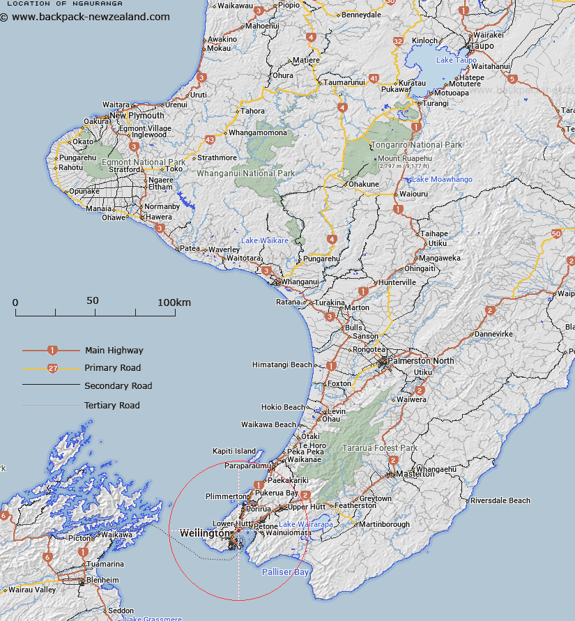
Map showing location of Ngauranga


LINZ description: Locality near the shore of Wellington Harbour 2.5km North-east of Kaiwharawhara and 5km South-east of Petone. Belmont Survey District.
Latitude: -41.245373
Longitude: 174.81285
Northing: 5432419
Easting: 1751900
Land District: Wellington
Feat Type: Locality


Scroll down to see a more detailed road map and below that a topographical map showing the location of Ngauranga. The road map has been supplied by openstreetmap and the topographical map of Ngauranga has been supplied by Land Information New Zealand (LINZ).

Yes you can use the top static map for you school/university project or personal website with a link back. Contact me for any commercial use.

Ngauranga Map New Zealand


New Zealand places in our database
[ A ] [ B ] [ C ] [ D ] [ E ] [ F ] [ G ] [ H ] [ I ] [ J ] [ K ] [ L ] [ M ] [ N ] [ O ] [ P ] [ Q ] [ R ] [ S ] [ T ] [ U ] [ V ] [ W ] [ X ] [ Y ] [ Z ]


Closest 20 Localitys to Ngauranga

Kaiwarawara ( 2.53km )   Kaiwhara ( 2.53km )   Kaiwharawhara ( 2.53km )   Kaiwara ( 2.53km )   Te Kainga ( 2.78km )   Te Kaianga ( 2.78km )   Te Hikowhenua ( 8.82km )   Makara Beach ( 8.84km )   Makara ( 9.38km )   Nai Nai ( 12.24km )   Naenae ( 12.24km )   Ngae Ngae ( 12.24km )   Colonial Knob ( 12.64km )   Haywards ( 17.46km )   Mana Island ( 17.76km )   Judgeford ( 18.55km )   Hongoeka ( 21.03km )   Whitemans Valley ( 24.25km )   Paek?k?riki Hill ( 24.54km )   Wharekauhau ( 26.69km )   Mangaroa ( 28.8km )   Maymorn ( 30.98km )   Te Marua ( 31.25km )   The Plateau ( 31.81km )   Lake Ferry ( 32.08km )   Te Ramaroa ( 33.32km )   MacKays Crossing ( 33.66km )   Mackays Crossing ( 33.66km )   Whangaimoana ( 34.25km )   Cross Creek ( 34.29km )   Pirinoa ( 34.55km )   Whareroa ( 34.8km )   Kaitoke ( 34.95km )   Kohunui Maori Settlement ( 35.27km )   Cloustonville ( 36.88km )   Pakuratahi ( 37.79km )   Tuhitarata ( 38.46km )   Pigeon Bush ( 38.76km )   Otaihanga ( 43.96km )   Kahutara ( 44.5km )