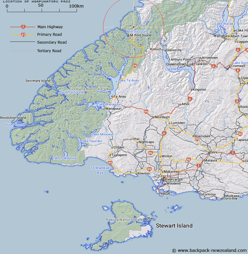
Map showing location of Ngapunatoru Pass


LINZ description: Pass above the source of the Harrison River, east of Lake Never-never, north west of Mount Tutoko and Donne Glacier.
Latitude: -44.567063
Longitude: 167.987208
Northing: 5052906.3
Easting: 1201943.4
Land District: Southland, Otago
Feat Type: Pass


Scroll down to see a more detailed road map and below that a topographical map showing the location of Ngapunatoru Pass. The road map has been supplied by openstreetmap and the topographical map of Ngapunatoru Pass has been supplied by Land Information New Zealand (LINZ).

Yes you can use the top static map for you school/university project or personal website with a link back. Contact me for any commercial use.

Ngapunatoru Pass Map New Zealand


New Zealand places in our database
[ A ] [ B ] [ C ] [ D ] [ E ] [ F ] [ G ] [ H ] [ I ] [ J ] [ K ] [ L ] [ M ] [ N ] [ O ] [ P ] [ Q ] [ R ] [ S ] [ T ] [ U ] [ V ] [ W ] [ X ] [ Y ] [ Z ]


Closest 20 Passs to Ngapunatoru Pass

Bowen Col ( 4.79km )   Turner Pass ( 5.69km )   O'Leary Pass ( 6.75km )   Pakihaukea Pass ( 8.45km )   Little Homer Saddle ( 11.76km )   Crampon Pass ( 13.69km )   Darran Pass ( 16.03km )   Serpentine Saddle ( 16.6km )   Cow Saddle ( 17.57km )   North Col ( 17.84km )   Adelaide Saddle ( 18.02km )   Park Pass ( 18.37km )   Alabaster Pass ( 18.49km )   Grave-Talbot Pass ( 18.87km )   Fiery Col ( 19.19km )   Gertrude Saddle ( 19.6km )   Lyttles Dip ( 19.96km )   Traverse Pass ( 20.04km )   Homer's Saddle ( 21.39km )   Homer Saddle ( 21.39km )   Fohn Saddle ( 22.01km )   Jamestown Saddle ( 23.12km )   Emily Pass ( 25.81km )   Four Brothers Pass ( 26.32km )   Sugarloaf Pass ( 26.34km )   Marshall Pass ( 28.59km )   Possibility Col ( 28.85km )   Beresford Pass ( 28.9km )   Valpys Pass ( 28.93km )   Glacier Col ( 29.22km )   Intervention Saddle ( 30.18km )   The Divide ( 30.53km )   Desperation Pass ( 30.98km )   Greenstone Saddle ( 31.42km )   Climax Col ( 31.51km )   Mackinnon Pass ( 31.98km )   Seal Col ( 32.02km )   Forgotten River Col ( 32.35km )   Stag Pass ( 32.79km )   Solution Col ( 32.84km )