Map showing location of Mulligan Creek


LINZ description: Feature shown on: NZMS260 O27 Edition 2 1994; NZTopo50-BQ26 251196-256204
Latitude: -41.370965
Longitude: 173.304729
Northing: 5420016.2
Easting: 1625484
Land District: Nelson
Feat Type: Stream


Scroll down to see a more detailed road map and below that a topographical map showing the location of Mulligan Creek. The road map has been supplied by openstreetmap and the topographical map of Mulligan Creek has been supplied by Land Information New Zealand (LINZ).

Yes you can use the top static map for you school/university project or personal website with a link back. Contact me for any commercial use.
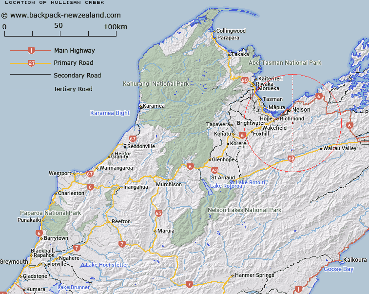
Mulligan Creek Map New Zealand


New Zealand places in our database
[ A ] [ B ] [ C ] [ D ] [ E ] [ F ] [ G ] [ H ] [ I ] [ J ] [ K ] [ L ] [ M ] [ N ] [ O ] [ P ] [ Q ] [ R ] [ S ] [ T ] [ U ] [ V ] [ W ] [ X ] [ Y ] [ Z ]


Closest 20 Streams to Mulligan Creek

Adams Creek ( 0.34km )   United Creek ( 0.43km )   Champion Creek ( 1.32km )   Bray Creek ( 1.46km )   Jackson Creek ( 1.97km )   Hilton Creek ( 3.14km )   Collins Creek ( 3.5km )   Coads Creek ( 4.01km )   Miner River ( 4.44km )   Roebuck Creek ( 5.03km )   Roding River ( 5.08km )   Mineral Stream ( 5.17km )   Stratford Creek ( 5.45km )   Rocks Creek ( 5.46km )   Browning Stream ( 5.57km )   The Brook ( 5.64km )   Middy Creek ( 6.37km )   Cummins Creek ( 6.64km )   Orphanage Stream ( 6.9km )   M?hanga Creek ( 6.93km )   Poorman Valley Stream ( 6.99km )   Sclanders Creek ( 7.1km )   Hacket Creek ( 7.2km )   Glen Creek ( 7.29km )   Neds Creek ( 7.56km )   Weka Creek ( 7.77km )   Maitai River South Branch ( 7.81km )   The Wrey ( 7.95km )   Jenkins Creek ( 8.16km )   Saxton Creek ( 8.17km )   Mates Creek ( 8.29km )   Echo Stream ( 8.4km )   Groom Creek ( 8.6km )   Saddle Creek ( 8.71km )   Beachamp Creek ( 8.87km )   Reservoir Creek ( 8.87km )   Richmond Stream ( 9.23km )   Serpentine River ( 9.55km )   Laing Creek ( 9.74km )   Toi Creek ( 9.86km )