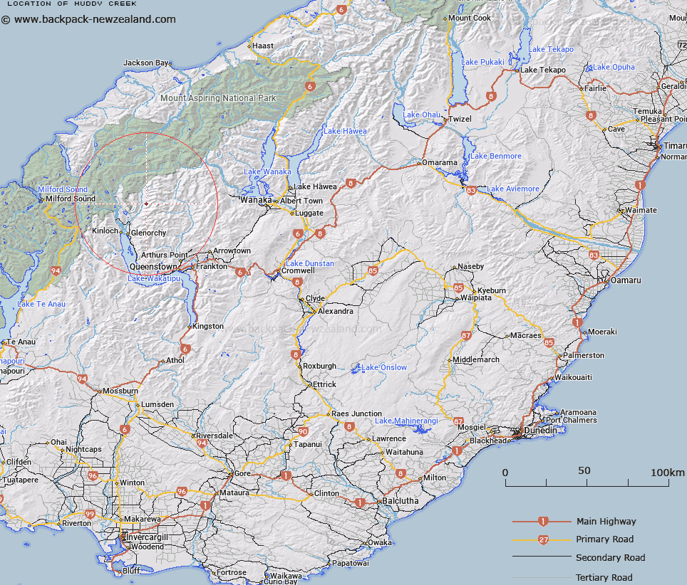
Map showing location of Muddy Creek


LINZ description: North of Cone Hill Trig. Flows west into the Rees River. Earnslaw Survey District.
Latitude: -44.694005
Longitude: 168.486581
Northing: 5041123.8
Easting: 1242381
Land District: Otago
Feat Type: Stream


Scroll down to see a more detailed road map and below that a topographical map showing the location of Muddy Creek. The road map has been supplied by openstreetmap and the topographical map of Muddy Creek has been supplied by Land Information New Zealand (LINZ).

Yes you can use the top static map for you school/university project or personal website with a link back. Contact me for any commercial use.

Muddy Creek Map New Zealand


New Zealand places in our database
[ A ] [ B ] [ C ] [ D ] [ E ] [ F ] [ G ] [ H ] [ I ] [ J ] [ K ] [ L ] [ M ] [ N ] [ O ] [ P ] [ Q ] [ R ] [ S ] [ T ] [ U ] [ V ] [ W ] [ X ] [ Y ] [ Z ]


Closest 20 Streams to Muddy Creek

Bridges Creek ( 1.22km )   Rees River ( 1.86km )   Invincible Creek ( 3.22km )   Arthurs Creek ( 3.24km )   Rough Creek ( 3.94km )   McDougalls Creek ( 4.73km )   Earnslaw Burn ( 5.13km )   Little Devil Creek ( 6.65km )   Big Devil Creek ( 7.45km )   Lennox Creek ( 7.48km )   Stair Creek ( 7.73km )   Robertson Creek ( 8.02km )   River Jordan ( 8.27km )   Savage Burn ( 8.53km )   Lima Creek ( 9.11km )   Gilkison Stream ( 9.15km )   Twenty Five Mile Creek ( 9.85km )   Sixteen Mile Creek ( 9.85km )   Twelve Mile Creek or Ox Burn ( 9.93km )   Hunter Creek ( 9.94km )   Dundas Creek ( 10.82km )   Davidsons Creek ( 11.09km )   Rough Creek ( 11.64km )   Duncans Creek ( 11.7km )   Diamond Creek ( 11.94km )   Hunter Creek South Branch ( 12.15km )   Seventeen Mile Creek ( 12.42km )   Flood Burn ( 13.03km )   Hunter Creek North Branch ( 13.04km )   Hunter Creek West Branch ( 13.3km )   Glencairn Creek ( 13.39km )   Bedford Stream ( 14.04km )   Ballarat Creek ( 14.48km )   Lake Creek ( 14.58km )   Campbells Creek ( 14.63km )   Precipice Creek or Temple Burn ( 14.74km )   Dart River/Te Awa Whakatipu ( 15.35km )   Dart River ( 15.35km )   Copper Creek ( 15.63km )   Aurum Creek ( 15.93km )