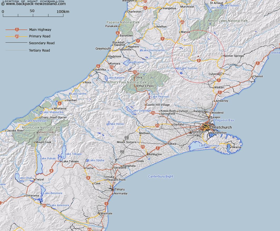
Map showing location of Mount Schiehallion


LINZ description: Mountain along the Poplars Range, south of the Lewis Pass
Latitude: -42.529968
Longitude: 172.491511
Northing: 5291254.1
Easting: 1558239.3
Land District: Canterbury
Feat Type: Hill


Scroll down to see a more detailed road map and below that a topographical map showing the location of Mount Schiehallion. The road map has been supplied by openstreetmap and the topographical map of Mount Schiehallion has been supplied by Land Information New Zealand (LINZ).

Yes you can use the top static map for you school/university project or personal website with a link back. Contact me for any commercial use.
Mount Schiehallion Map New Zealand


New Zealand places in our database
[ A ] [ B ] [ C ] [ D ] [ E ] [ F ] [ G ] [ H ] [ I ] [ J ] [ K ] [ L ] [ M ] [ N ] [ O ] [ P ] [ Q ] [ R ] [ S ] [ T ] [ U ] [ V ] [ W ] [ X ] [ Y ] [ Z ]


Closest 20 Hills to Mount Schiehallion

Mount Saint Andrew ( 3.16km )   Mons Sex Millia ( 3.46km )   Horseshoe Hill ( 4.2km )   Martha ( 6.31km )   Garnet Peak ( 6.96km )   Faust ( 7.17km )   Handyside ( 7.56km )   Fandang ( 7.58km )   Mephistopheles ( 7.96km )   Mount Kakapo ( 9.01km )   Maritana ( 9.05km )   Mount Lucia ( 11.17km )   Billhook Peak ( 11.6km )   Rokeby ( 12.96km )   Frozen Hill ( 13.17km )   Saint Mary ( 13.28km )   Grey Hill ( 13.39km )   Shale Peak ( 14.54km )   Norma ( 14.59km )   Charlies Hill ( 14.66km )   Mount Skiddaw ( 14.88km )   Mount Scaife ( 15.25km )   Miromiro ( 15.42km )   Windy Knob ( 15.81km )   Mount Douglas ( 16.03km )   Travers Peak ( 16.4km )   Mount Garfield ( 16.64km )   Mount Skedaddle ( 16.72km )   Scaw Fell ( 16.77km )   Mount Woolley ( 16.84km )   Mount Esther ( 17.19km )   Rodney ( 17.37km )   Mount Scott ( 17.58km )   Mount Technical ( 17.62km )   Spider Web ( 17.64km )   The Devils Rampart ( 17.82km )   Trovatore ( 17.85km )   Discovery Peak ( 17.86km )   Tabletop ( 17.99km )   Mount Jervois ( 18.01km )