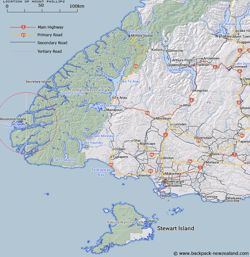
Map showing location of Mount Phillips


LINZ description: A mountain on Resolution Island, west of Duck Cove. Instead of Mount Philipps, shown on current maps
Latitude: -45.719559
Longitude: 166.624523
Northing: 4917308.3
Easting: 1103870
Land District: Southland
Feat Type: Hill


Scroll down to see a more detailed road map and below that a topographical map showing the location of Mount Phillips. The road map has been supplied by openstreetmap and the topographical map of Mount Phillips has been supplied by Land Information New Zealand (LINZ).

Yes you can use the top static map for you school/university project or personal website with a link back. Contact me for any commercial use.

Mount Phillips Map New Zealand


New Zealand places in our database
[ A ] [ B ] [ C ] [ D ] [ E ] [ F ] [ G ] [ H ] [ I ] [ J ] [ K ] [ L ] [ M ] [ N ] [ O ] [ P ] [ Q ] [ R ] [ S ] [ T ] [ U ] [ V ] [ W ] [ X ] [ Y ] [ Z ]


Closest 20 Hills to Mount Phillips

Mount Lyall ( 4.78km )   Mount Forbes ( 4.91km )   Mount Roa ( 5.71km )   Mount Clerke ( 5.96km )   Mount Lort ( 6.67km )   Mount Evans ( 9.01km )   Mount Sparrman ( 9.33km )   Mount Wales ( 9.75km )   Mount Foster ( 11.15km )   Mount Forster ( 11.15km )   Mount Hodges ( 11.43km )   Mount Patten ( 12.69km )   Mount Bradshaw ( 14.68km )   Mount Burnett ( 15.66km )   Mount Inaccessible ( 17.99km )   Mount Richards ( 18.3km )   The Stopper ( 18.58km )   Mount Pender ( 19.42km )   Saddle Hill ( 20.1km )   Square Top ( 20.11km )   Mount Edgecumbe ( 20.53km )   Mount Wallis ( 21.22km )   Perpendicular Peak ( 21.8km )   The Brothers ( 24.11km )   The Lump ( 24.37km )   Mount Anderson ( 25km )   Needle Peak ( 26.68km )   Mount Kellard ( 26.93km )   Mount Vera ( 28.58km )   Calm Peak ( 29.23km )   Mount Solitary ( 29.67km )   Tussock Peak ( 30.68km )   Mount Chisholm ( 31.08km )   Treble Mountain ( 31.98km )   Sea View Peak ( 32.89km )   Kathryn Peak ( 33.41km )   Mount Pember ( 34.02km )   Mount Fitchett ( 34.12km )   Mount Thompson ( 34.2km )   Sugarloaf ( 34.48km )