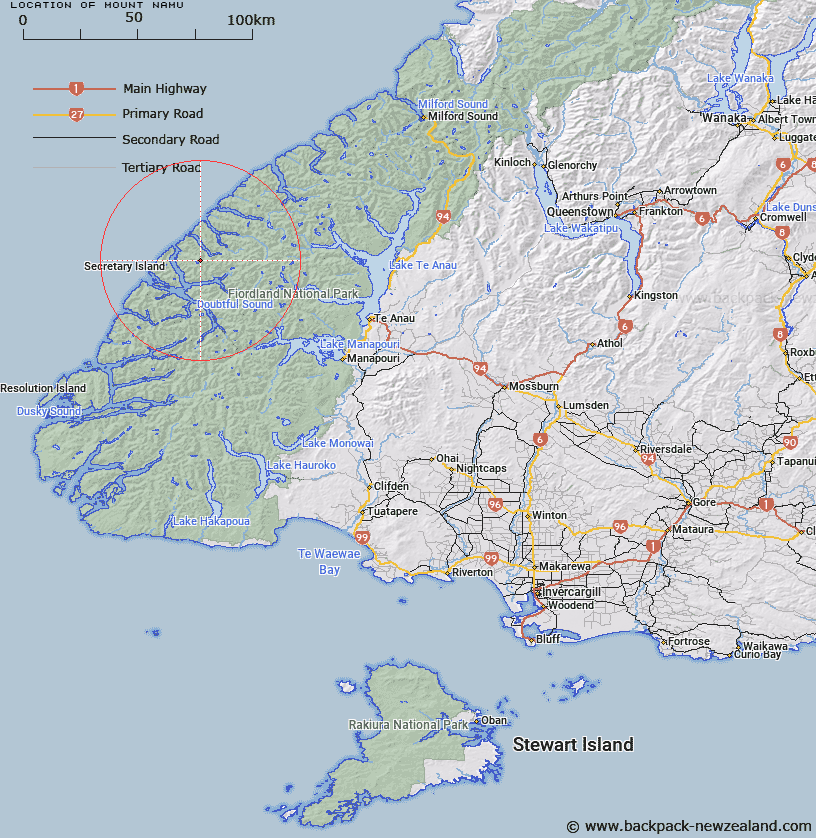
Map showing location of Mount Namu


LINZ description: Half a mile west of Trio Peaks, near Heel Cove, Nancy Sound. 4,250 ft
Latitude: -45.197741
Longitude: 167.069008
Northing: 4977944.5
Easting: 1134163.5
Land District: Southland
Feat Type: Hill


Scroll down to see a more detailed road map and below that a topographical map showing the location of Mount Namu. The road map has been supplied by openstreetmap and the topographical map of Mount Namu has been supplied by Land Information New Zealand (LINZ).

Yes you can use the top static map for you school/university project or personal website with a link back. Contact me for any commercial use.

Mount Namu Map New Zealand


New Zealand places in our database
[ A ] [ B ] [ C ] [ D ] [ E ] [ F ] [ G ] [ H ] [ I ] [ J ] [ K ] [ L ] [ M ] [ N ] [ O ] [ P ] [ Q ] [ R ] [ S ] [ T ] [ U ] [ V ] [ W ] [ X ] [ Y ] [ Z ]


Closest 20 Hills to Mount Namu

Dunsterville Peaks ( 2.96km )   Hamley Peak ( 4.01km )   Crayfish Heights ( 4.99km )   Medley Peak ( 6.01km )   Mount Napier ( 6.37km )   Glengarry Peak ( 6.43km )   Evans Peak ( 7.71km )   Command Peak ( 8.19km )   Key Peak ( 8.45km )   Saddle Back Peak ( 8.45km )   Mount Grono ( 11.89km )   Mount Groznoz ( 11.89km )   Forden Peak ( 12.35km )   Victor Peak ( 12.4km )   All Round Peak ( 12.53km )   Turn Peak ( 12.62km )   The Hub ( 13.04km )   Rectory Peak ( 14.3km )   Double Peak ( 15.38km )   Mount Patanga ( 16.01km )   Coronation Peak ( 16.44km )   Mount Wera ( 18.04km )   Mount Paulina ( 19.34km )   Fleetwood Peak ( 20.85km )   Mount Forbes ( 22.44km )   Mount Irene ( 22.85km )   Mount Hall ( 22.95km )   Mount Fannin ( 23.31km )   Christmas Hill ( 23.33km )   Mount Scott ( 23.59km )   Mount Baird ( 23.83km )   Gerald Peak ( 24.2km )   Mount Fowler ( 24.6km )   Ardneil Peak ( 24.71km )   Mount Soaker ( 25.14km )   Mount Pluvius ( 25.18km )   Pluvius Mountain ( 25.18km )   Mount Tanilba ( 25.57km )   Mount Alexander ( 26.06km )   Camp Hill ( 26.36km )