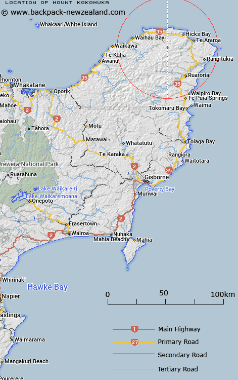
Map showing location of Mount Kokomuka


LINZ description: Mountain located in Opuawhanga survey district, 4km north of Kopuapounamu River
Latitude: -37.686187
Longitude: 178.171168
Northing: 5816400
Easting: 2056100
Land District: Gisborne
Feat Type: Hill


Scroll down to see a more detailed road map and below that a topographical map showing the location of Mount Kokomuka. The road map has been supplied by openstreetmap and the topographical map of Mount Kokomuka has been supplied by Land Information New Zealand (LINZ).

Yes you can use the top static map for you school/university project or personal website with a link back. Contact me for any commercial use.

Mount Kokomuka Map New Zealand


New Zealand places in our database
[ A ] [ B ] [ C ] [ D ] [ E ] [ F ] [ G ] [ H ] [ I ] [ J ] [ K ] [ L ] [ M ] [ N ] [ O ] [ P ] [ Q ] [ R ] [ S ] [ T ] [ U ] [ V ] [ W ] [ X ] [ Y ] [ Z ]


Closest 20 Hills to Mount Kokomuka

Te Kapua ( 3.9km )   Pukekaka ( 4.29km )   The Watch Dog ( 6.43km )   Taumaoteawhengaiao ( 6.98km )   Pukeamaru ( 7.14km )   Parahaki ( 9.14km )   Raukumara ( 9.39km )   Mataraua ( 9.95km )   Whakatiki ( 10.33km )   Rakitawhero ( 10.63km )   Ngawhakatatara ( 11.18km )   Whakaangiangi ( 11.56km )   Pakira ( 12.2km )   Aoparauri ( 12.3km )   Te Pekaoterangihekeiho ( 12.85km )   Komapara ( 13.53km )   Ahiapurua ( 14.76km )   Pungarehunui ( 14.88km )   Taraketiti ( 14.9km )   Te Mahuna ( 15.04km )   Te Kohe ( 15.73km )   Hakaonga ( 15.82km )   Hakainga ( 15.82km )   Wharikirauponga ( 16.38km )   Te Koau ( 16.44km )   Maungahiha ( 16.6km )   Tipari ( 16.63km )   Ruahakoakoa ( 16.72km )   Mangairoa ( 16.98km )   Patangata ( 17.4km )   Ouewheki ( 17.67km )   Otarapaoa ( 17.68km )   Ngatohuahira ( 18.09km )   Tutaewhakapiki ( 18.35km )   Tapuaeharuru ( 18.39km )   Pukepoto ( 19.17km )   Taumataorei ( 19.37km )   Te Ranginui ( 20.56km )   Puketawai ( 20.62km )   Tutara ( 21.22km )