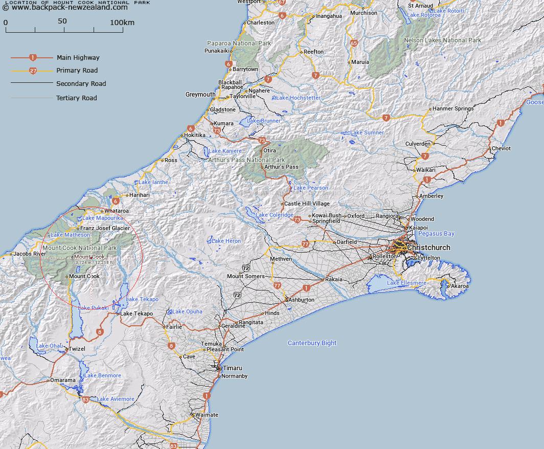
Map showing location of Mount Cook National Park
LINZ description: Altered from Mount Cook National Park by Ngāi Tahu Claims Settlement Act 1998
Latitude: -43.599748
Longitude: 170.285431
Northing: 5169000
Easting: 1380900
Land District: Canterbury
Feat Type: National Park
Latitude: -43.599748
Longitude: 170.285431
Northing: 5169000
Easting: 1380900
Land District: Canterbury
Feat Type: National Park

Scroll down to see a more detailed road map and below that a topographical map showing the location of Mount Cook National Park. The road map has been supplied by openstreetmap and the topographical map of Mount Cook National Park has been supplied by Land Information New Zealand (LINZ).
Yes you can use the top static map for you school/university project or personal website with a link back. Contact me for any commercial use.
[ A ] [ B ] [ C ] [ D ] [ E ] [ F ] [ G ] [ H ] [ I ] [ J ] [ K ] [ L ] [ M ] [ N ] [ O ] [ P ] [ Q ] [ R ] [ S ] [ T ] [ U ] [ V ] [ W ] [ X ] [ Y ] [ Z ]