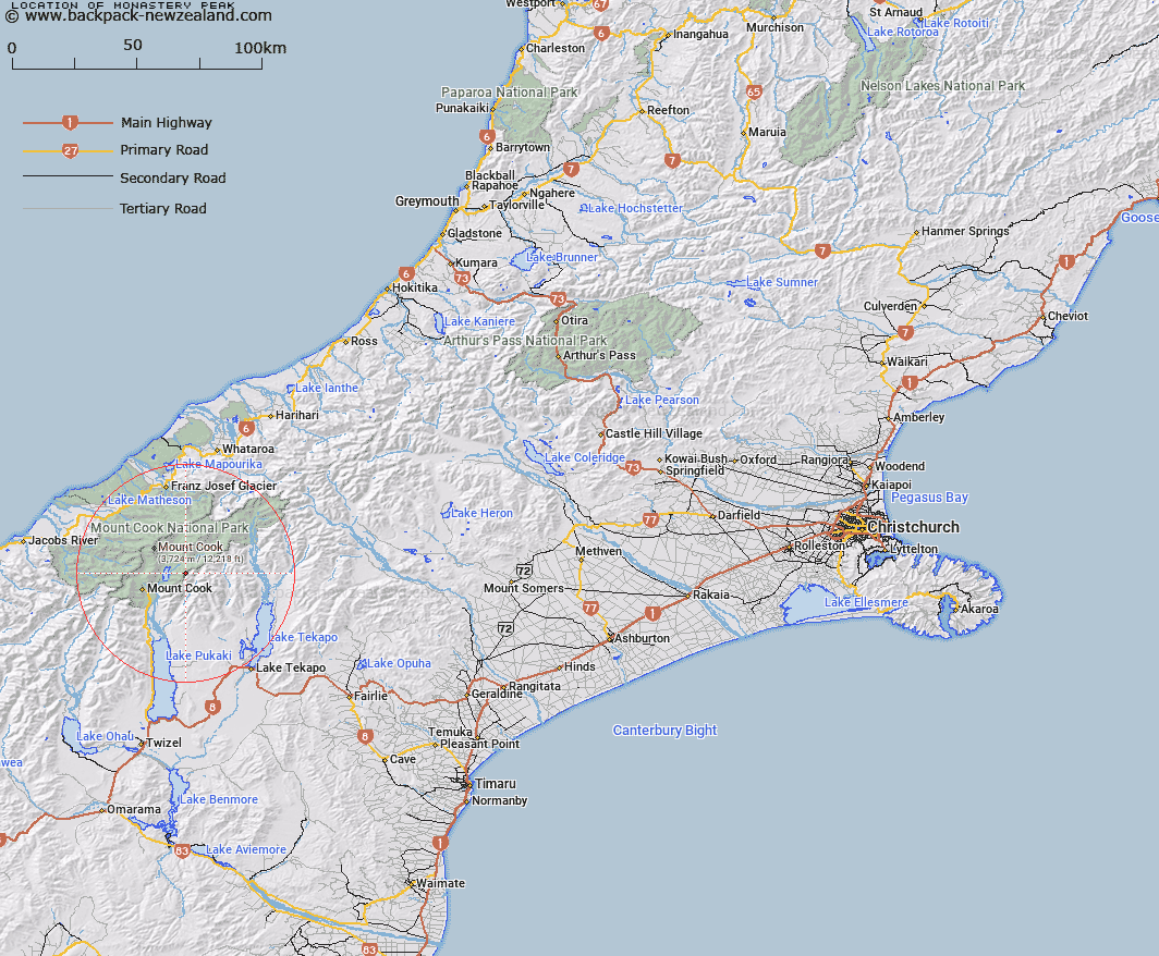
Map showing location of Monastery Peak


LINZ description: Peak at 2580m on Liebig Range, half a mile north-east of Mount Biretta. Cass Survey District.
Latitude: -43.679937
Longitude: 170.254307
Northing: 5160011.1
Easting: 1378682.6
Land District: Canterbury
Feat Type: Hill


Scroll down to see a more detailed road map and below that a topographical map showing the location of Monastery Peak. The road map has been supplied by openstreetmap and the topographical map of Monastery Peak has been supplied by Land Information New Zealand (LINZ).

Yes you can use the top static map for you school/university project or personal website with a link back. Contact me for any commercial use.

Monastery Peak Map New Zealand


New Zealand places in our database
[ A ] [ B ] [ C ] [ D ] [ E ] [ F ] [ G ] [ H ] [ I ] [ J ] [ K ] [ L ] [ M ] [ N ] [ O ] [ P ] [ Q ] [ R ] [ S ] [ T ] [ U ] [ V ] [ W ] [ X ] [ Y ] [ Z ]


Closest 20 Hills to Monastery Peak

Mount Biretta ( 1.06km )   The Nuns Veil ( 1.6km )   The Armchair ( 2.29km )   Abbess ( 2.97km )   Abbot ( 3.46km )   The Acolyte ( 3.52km )   Mount Bruce ( 3.84km )   Jollie Peak ( 4.53km )   Mount Little ( 5.01km )   Mount William Grant ( 6.03km )   Mount Jukes ( 6.46km )   The Twins ( 6.6km )   Novara Peak ( 6.66km )   Malcher Peak ( 7.74km )   Brass Peak ( 7.74km )   The Needles ( 8.05km )   Burnett Mountains ( 8.23km )   Mount Johnson ( 8.51km )   Mount Fagin ( 8.62km )   Mount Tamaki ( 8.86km )   Mount Lucia ( 8.92km )   Kaitiaki Peak ( 8.97km )   Mount Mabel ( 9.03km )   Mount Rosa ( 9.03km )   Mount Blackburn ( 9.46km )   Mount Kinsey ( 9.55km )   Turner Peak ( 9.74km )   Proud Peak ( 9.87km )   Pibrac ( 10.22km )   Mount Chudleigh ( 10.49km )   Mount Kea ( 10.55km )   Mount Wakefield ( 10.56km )   Anzac Peaks ( 10.73km )   Mount Nathan ( 11km )   Mount Caitriana ( 11.01km )   Nazomi ( 11.02km )   Mount German ( 11.54km )   Aiguilles Rouges ( 11.79km )   Low Peak ( 12.15km )   Middle Peak ( 12.31km )