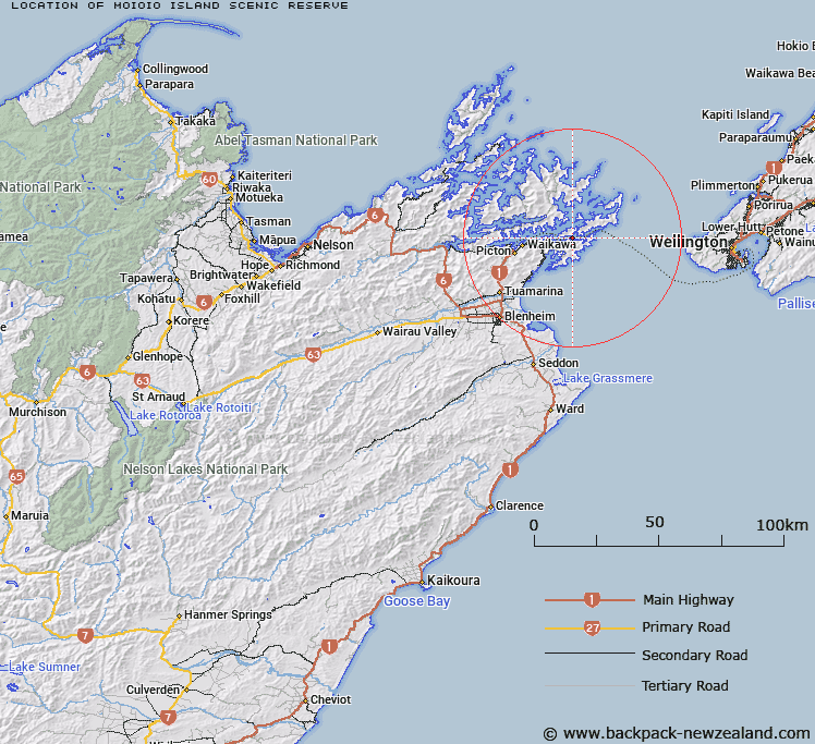
Map showing location of Moioio Island Scenic Reserve


LINZ description: As shown in Te Ātiawa o Te Waka-a-Māui Deed of Settlement Plan OTS-202-19. Described as 0.7960 hectares, more or less, being Section 1 SO 446852. Part Proclamation 330. NZTopo50-BQ29 018334.
Latitude: -41.244167
Longitude: 174.215278
Northing: 5433425.5
Easting: 1701829.6
Land District: Marlborough
Feat Type: Scenic Reserve


Scroll down to see a more detailed road map and below that a topographical map showing the location of Moioio Island Scenic Reserve. The road map has been supplied by openstreetmap and the topographical map of Moioio Island Scenic Reserve has been supplied by Land Information New Zealand (LINZ).

Yes you can use the top static map for you school/university project or personal website with a link back. Contact me for any commercial use.

Moioio Island Scenic Reserve Map New Zealand


New Zealand places in our database
[ A ] [ B ] [ C ] [ D ] [ E ] [ F ] [ G ] [ H ] [ I ] [ J ] [ K ] [ L ] [ M ] [ N ] [ O ] [ P ] [ Q ] [ R ] [ S ] [ T ] [ U ] [ V ] [ W ] [ X ] [ Y ] [ Z ]


Closest 20 Scenic Reserves to Moioio Island Scenic Reserve

Katoa Point Scenic Reserve ( 1.69km )   Ngaruru Scenic Reserve ( 2.74km )   Malcolm's Bay Scenic Reserve ( 3.36km )   Ruaomoko Point Scenic Reserve ( 3.39km )   Dieffenbach Point Scenic Reserve ( 6.21km )   Spenser Bay Scenic Reserve ( 7km )   Patten Passage Scenic Reserve ( 7.83km )   Blumine Island Scenic Reserve ( 8.17km )   Ruakaka Bay Scenic Reserve ( 8.82km )   Kahikatea Scenic Reserve ( 9.01km )   Bay Of Many Coves Scenic Reserve ( 9.22km )   Goodwin Bay Scenic Reserve ( 9.63km )   Edgecombe Point Scenic Reserve ( 9.68km )   Toenga Scenic Reserve ( 10.76km )   Pickersgill Island Scenic Reserve ( 10.87km )   Tunoamai Point Scenic Reserve ( 11.03km )   Blackwood Bay Scenic Reserve ( 11.35km )   Golden Point Scenic Reserve ( 11.65km )   School House Bay Scenic Reserve ( 11.91km )   Karaka Point Historic & Scenic Reserve ( 12.6km )   Allports Island Scenic Reserve ( 13.29km )   Tawa Bay Scenic Reserve ( 13.76km )   Kumutoto Scenic Reserve ( 13.82km )   Resolution Bay Scenic Reserve ( 14.98km )   Torea Scenic Reserve ( 15.11km )   Long Island Scenic Reserve ( 15.17km )   Arapawa Island Scenic Reserve ( 15.51km )   Cooper Point Scenic Reserve ( 16.04km )   Big Bay Scenic Reserve ( 16.31km )   Rocks Scenic Reserve ( 16.74km )   Mabel Island Scenic Reserve ( 17.01km )   Picton Scenic Reserve ( 17.06km )   Robertson Range Scenic Reserve ( 17.16km )   Howdens Bush Scenic Reserve ( 17.2km )   Waitaria Bay Scenic Reserve ( 17.45km )   Pukatea Bay Scenic Reserve ( 17.49km )   Motuara Island Scenic & Historic Reserve ( 17.68km )   Kaipupu Point Scenic Reserve ( 17.78km )   Clark Island Scenic Reserve ( 18.02km )   Endeavour Inlet Scenic Reserve ( 18.24km )