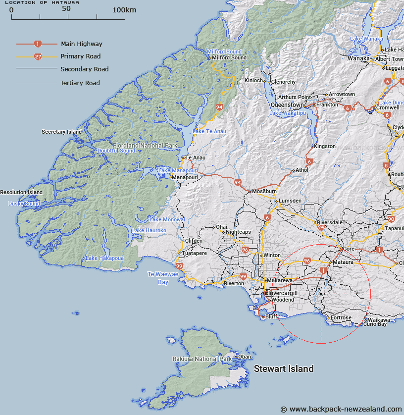
Map showing location of Mataura


LINZ description: West of Mataura locality and the Mataura River. Trig A0QA at 110m height.
Latitude: -46.4277
Longitude: 168.786809
Northing: 4849800
Easting: 1276300
Land District: Southland
Feat Type: Trig Station


Scroll down to see a more detailed road map and below that a topographical map showing the location of Mataura. The road map has been supplied by openstreetmap and the topographical map of Mataura has been supplied by Land Information New Zealand (LINZ).

Yes you can use the top static map for you school/university project or personal website with a link back. Contact me for any commercial use.

Mataura Map New Zealand


New Zealand places in our database
[ A ] [ B ] [ C ] [ D ] [ E ] [ F ] [ G ] [ H ] [ I ] [ J ] [ K ] [ L ] [ M ] [ N ] [ O ] [ P ] [ Q ] [ R ] [ S ] [ T ] [ U ] [ V ] [ W ] [ X ] [ Y ] [ Z ]


Closest 20 Trig Stations to Mataura

Toetoes ( 11.21km )   Fortrose ( 20.68km )   Mokoreta ( 20.78km )   Forest Hill ( 38.88km )   Kelvin Peak ( 40.6km )   Glenomaru ( 68.21km )   Waiparu ( 69.77km )   Gowan Hill ( 80.32km )   Hyde Rock ( 119.88km )   North Taieri ( 136.69km )   McArthny ( 160.52km )   Waikouaiti ( 171.65km )   Jeffrey ( 180.78km )   Waihemo ( 184.39km )   Obi ( 190.71km )   Tor ( 192.04km )   The Rock ( 192.73km )   Moeraki ( 197.67km )   Kauru Hill ( 210.35km )   Kauroo Hill ( 210.35km )   Kohurau ( 216.52km )   Pentland Hill ( 252.86km )   Yellow Hill ( 252.86km )   Te Huruhuru ( 272.54km )   Chastleton ( 305.91km )   Coldstream ( 331.99km )   Rangitata ( 331.99km )   Rabbit Hill ( 361.86km )   Round Top ( 399.43km )   Tara ( 414.04km )   Kowhitirangi ( 430.43km )   Koiterangi ( 430.43km )   Tihiokahukura ( 440.65km )   Harris ( 445.4km )   Weka ( 489.81km )   Pahau ( 513.23km )   Flintoft ( 526.51km )   Flintoff ( 526.51km )   Mount Saul ( 526.75km )   Faerie Queene ( 549.6km )