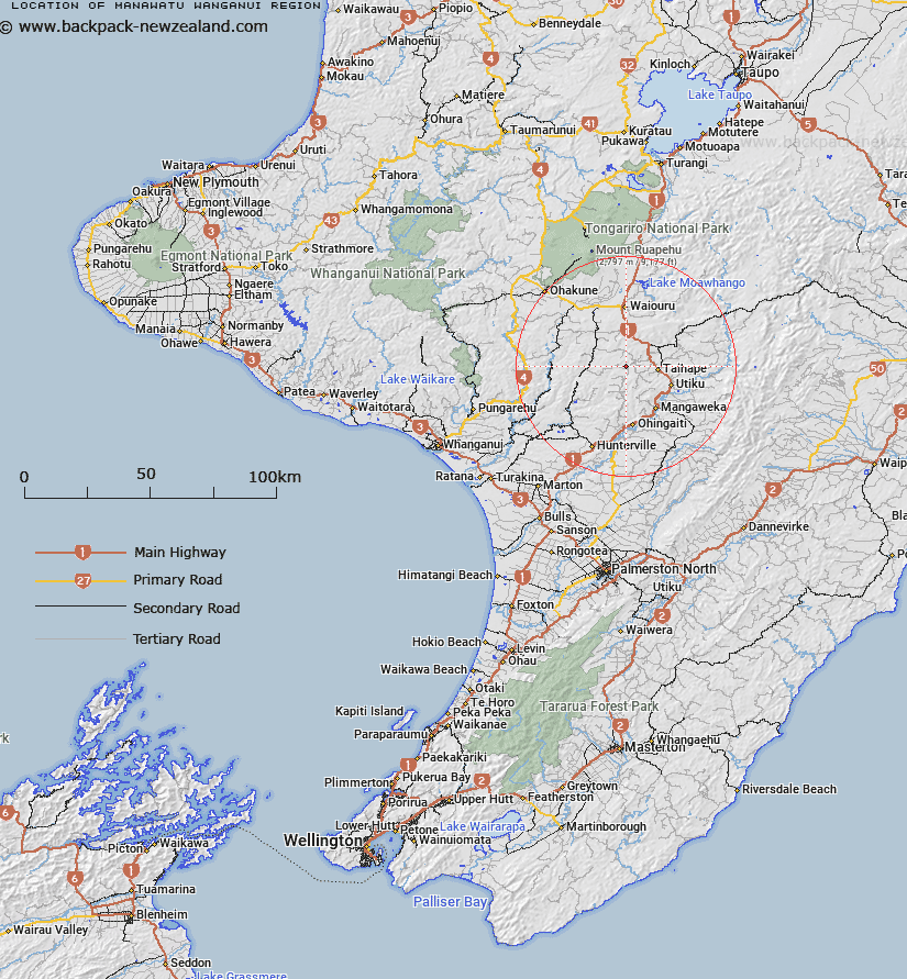
Map showing location of Manawatu-Wanganui Region


LINZ description: The region that is administered by the Manawatu-Wanganui Regional Council (Horizons Regional Council).
Latitude: -39.668492
Longitude: 175.686145
Northing: 5605586.7
Easting: 1830409.3
Land District: Wellington
Feat Type: Local Government


Scroll down to see a more detailed road map and below that a topographical map showing the location of Manawatu-Wanganui Region. The road map has been supplied by openstreetmap and the topographical map of Manawatu-Wanganui Region has been supplied by Land Information New Zealand (LINZ).

Yes you can use the top static map for you school/university project or personal website with a link back. Contact me for any commercial use.

Manawatu-Wanganui Region Map New Zealand


New Zealand places in our database
[ A ] [ B ] [ C ] [ D ] [ E ] [ F ] [ G ] [ H ] [ I ] [ J ] [ K ] [ L ] [ M ] [ N ] [ O ] [ P ] [ Q ] [ R ] [ S ] [ T ] [ U ] [ V ] [ W ] [ X ] [ Y ] [ Z ]


Closest 20 Local Governments to Manawatu-Wanganui Region

Manawatu-Wanganui Region ( 0km )   Rangitikei District ( 7.95km )   Manawatu District ( 51km )   Ruapehu District ( 66.97km )   Palmerston North City ( 79.42km )   Central Hawke's Bay District ( 81.27km )   Hawke's Bay Region ( 84.52km )   Hastings District ( 85.21km )   Stratford District ( 87.81km )   Tararua District ( 89.1km )   Taupo District ( 94.93km )   Horowhenua District ( 97.87km )   Hawke's Bay County ( 102.99km )   Hawke's Bay Province ( 103.32km )   Napier City ( 103.93km )   South Taranaki District ( 107.98km )   Taranaki Region ( 130.12km )   Waitomo District ( 135.23km )   Kapiti Coast District ( 138.33km )   Masterton District ( 139.13km )   New Plymouth District ( 139.28km )   Wellington Region ( 154.75km )   Wairoa District ( 156.45km )   Otorohanga District ( 162.62km )   Carterton District ( 164.63km )   Rotorua District ( 167.91km )   Upper Hutt City ( 171.29km )   South Waikato District ( 171.75km )   Porirua City ( 174.43km )   Bay of Plenty Region ( 176.38km )   Whakatane District ( 177.36km )   South Wairarapa District ( 180km )   Borough of Tawa ( 182.27km )   Borough of Tawa Flat ( 182.27km )   Lower Hutt City ( 184.01km )   Petone Borough ( 186.37km )   Pito-one Borough ( 186.37km )   Kawerau District ( 190.15km )   Waipa District ( 190.47km )   Wellington City ( 190.97km )