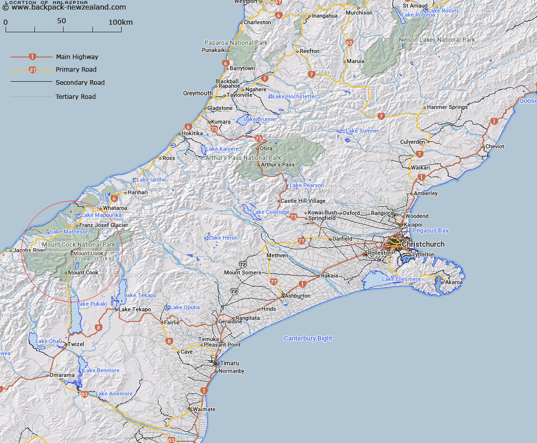
Map showing location of Malaspina


LINZ description: On Main Divide immediately south of Clarke Saddle. Mount Cook & Mueller Survey Districts.
Latitude: -43.578323
Longitude: 170.145209
Northing: 5171000
Easting: 1369500
Land District: Canterbury, Westland
Feat Type: Hill


Scroll down to see a more detailed road map and below that a topographical map showing the location of Malaspina. The road map has been supplied by openstreetmap and the topographical map of Malaspina has been supplied by Land Information New Zealand (LINZ).

Yes you can use the top static map for you school/university project or personal website with a link back. Contact me for any commercial use.

Malaspina Map New Zealand


New Zealand places in our database
[ A ] [ B ] [ C ] [ D ] [ E ] [ F ] [ G ] [ H ] [ I ] [ J ] [ K ] [ L ] [ M ] [ N ] [ O ] [ P ] [ Q ] [ R ] [ S ] [ T ] [ U ] [ V ] [ W ] [ X ] [ Y ] [ Z ]


Closest 20 Hills to Malaspina

Malaspina ( 0km )   Mount Teichelmann ( 0.54km )   Graham Peak ( 0.7km )   Vancouver Mountain ( 0.8km )   Magellan ( 0.86km )   Drake ( 1.1km )   Silberhorn ( 1.24km )   Mount Dampier ( 1.31km )   Mount Hicks (Saint Davids Dome) ( 1.67km )   Mount Tasman ( 1.69km )   North Peak ( 1.88km )   High Peak ( 1.88km )   Mount Cook ( 1.91km )   Aoraki/Mount Cook ( 1.91km )   Vanguard ( 2.04km )   Torres Peak ( 2.07km )   Beatty Peak ( 2.7km )   Sturdee Peak ( 2.7km )   Middle Peak ( 2.77km )   Lendenfeld Peak ( 2.85km )   Le Receveur Peak ( 3.19km )   Receveur Peak ( 3.19km )   Dixon Peak ( 3.33km )   The Buttress ( 3.38km )   Mount Haast ( 3.39km )   Low Peak ( 3.4km )   Glacier Dome ( 3.42km )   Anzac Peaks ( 3.58km )   Jellicoe Peak ( 3.67km )   Big Mac ( 3.73km )   Belmont ( 4.07km )   Grey Peak ( 4.1km )   Low Mountain ( 4.22km )   Lowe Mountain ( 4.22km )   Nazomi ( 4.86km )   Storm ( 4.88km )   La Perouse ( 5km )   Mount Du Fresne ( 5.16km )   Mount Haidinger ( 5.31km )   Mount Alack ( 5.82km )