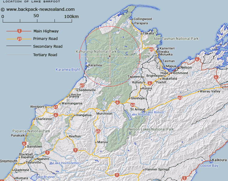
Map showing location of Lake Barfoot


LINZ description: Lake in the upper reaches of the Beautiful River, 2.3km North-east of False Peak. Leslie Survey District.
Latitude: -41.131004
Longitude: 172.397068
Northing: 5446525
Easting: 1549392.9
Land District: Nelson
Feat Type: Lake


Scroll down to see a more detailed road map and below that a topographical map showing the location of Lake Barfoot. The road map has been supplied by openstreetmap and the topographical map of Lake Barfoot has been supplied by Land Information New Zealand (LINZ).

Yes you can use the top static map for you school/university project or personal website with a link back. Contact me for any commercial use.

Lake Barfoot Map New Zealand


New Zealand places in our database
[ A ] [ B ] [ C ] [ D ] [ E ] [ F ] [ G ] [ H ] [ I ] [ J ] [ K ] [ L ] [ M ] [ N ] [ O ] [ P ] [ Q ] [ R ] [ S ] [ T ] [ U ] [ V ] [ W ] [ X ] [ Y ] [ Z ]


Closest 20 Lakes to Lake Barfoot

Lake Rotopai ( 2.48km )   Rotopai ( 2.48km )   Lake Jewell ( 2.55km )   Earthquake Lakes ( 8.43km )   Lake Aorere ( 9.82km )   Lake Henderson ( 11.35km )   Lake Elmer ( 11.99km )   Round Lake ( 12.04km )   Camp Lake ( 12.49km )   Lake Cobb ( 12.86km )   Island Lake ( 13.1km )   Mirror Tarn ( 16.64km )   Ruby Lake ( 16.83km )   Lake Peel ( 17.27km )   Lake Lillie ( 18.4km )   Diamond Lake ( 18.53km )   Iron Lake ( 18.55km )   Little Sylvester Lake ( 19.17km )   Lake Sylvester ( 19.56km )   Lake Lockett ( 19.95km )   Diamond Lakes ( 20.09km )   Cobb Reservoir ( 21.75km )   Lake Bellbird ( 21.75km )   Lake Stanley ( 22.62km )   Adelaide Tarn ( 24.38km )   Lake Sparrow ( 25.18km )   Lake Lindsay ( 25.8km )   Moonstone Lake ( 27.44km )   Black Lakes ( 28.05km )   Lake Clara ( 29.36km )   Shag Tarn ( 29.39km )   Darby Pond ( 29.39km )   Kinzett Tarn ( 29.43km )   Swampy Tarn ( 29.98km )   Saddle Lakes ( 30.31km )   Boulder Lake ( 30.34km )   Luna Lake ( 31.6km )   Lake William ( 34.99km )   Lake Fiddle ( 36.93km )   Lake Phyllis ( 39.24km )