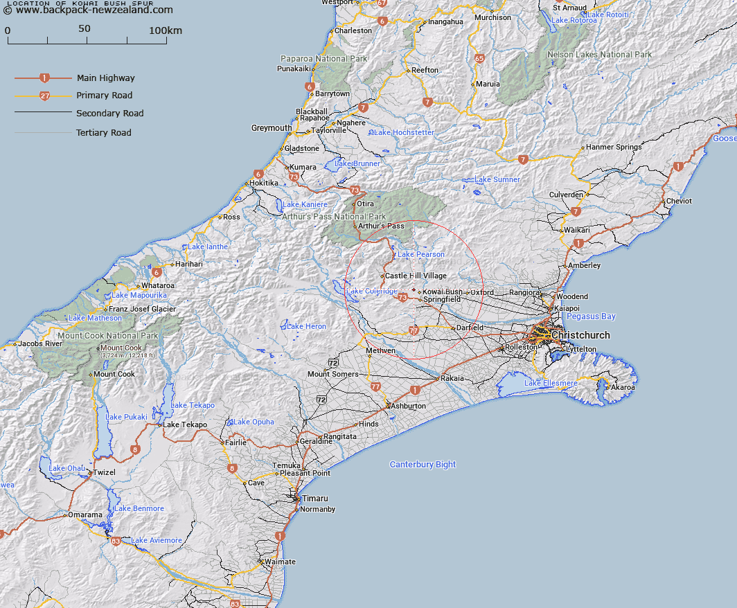
Map showing location of Kowai Bush Spur


LINZ description: Spur leading down to Kowai Bush from north-west
Latitude: -43.281767
Longitude: 171.893206
Northing: 5207300
Easting: 1510200
Land District: Canterbury
Feat Type: Ridge


Scroll down to see a more detailed road map and below that a topographical map showing the location of Kowai Bush Spur. The road map has been supplied by openstreetmap and the topographical map of Kowai Bush Spur has been supplied by Land Information New Zealand (LINZ).

Yes you can use the top static map for you school/university project or personal website with a link back. Contact me for any commercial use.

Kowai Bush Spur Map New Zealand


New Zealand places in our database
[ A ] [ B ] [ C ] [ D ] [ E ] [ F ] [ G ] [ H ] [ I ] [ J ] [ K ] [ L ] [ M ] [ N ] [ O ] [ P ] [ Q ] [ R ] [ S ] [ T ] [ U ] [ V ] [ W ] [ X ] [ Y ] [ Z ]


Closest 20 Ridges to Kowai Bush Spur

Lansdowne Spur ( 8.04km )   Foggy Peak Ridge ( 11.75km )   Cairn Ridge ( 17.56km )   Dead Man Spur ( 19.87km )   Coal Pit Spur ( 20.18km )   Long Spur ( 20.88km )   Homebush Ridge ( 21.52km )   Bald Hills ( 32.3km )   Junction Spur ( 37.16km )   The Spurs ( 37.92km )   Blind Spur ( 38.05km )   Hut Spur ( 39.63km )   Little Jordan Spur ( 40.47km )   Blackball Ridge ( 43.24km )   The Panhandle ( 46.13km )   Centre Spur ( 48.82km )   Rome Ridge ( 49.4km )   Jellicoe Ridge ( 50.02km )   Camp Spur ( 50.72km )   Goldney Ridge ( 50.9km )   The Brothers ( 51.02km )   Clay Spurs ( 55.42km )   Golden Spur ( 55.51km )   Rosamond Ridge ( 55.95km )   Cabot Ridge ( 56.2km )   Barron Ridge ( 56.75km )   Hunts Ridge ( 57.33km )   Reeses Ridge ( 58.17km )   Eliott Ridge ( 58.43km )   Eliot Ridge ( 58.43km )   Marshal Ridge ( 58.79km )   Marshall Ridge ( 58.79km )   Ricki Spur ( 59.86km )   Donovan Ridge ( 60.33km )   Woolshed Ridge ( 61.6km )   Brunswick Ridge ( 63.12km )   Long Spur ( 63.41km )   Dog Hill ( 63.85km )   Treachery Ridge ( 63.97km )   The Brothers ( 64.56km )