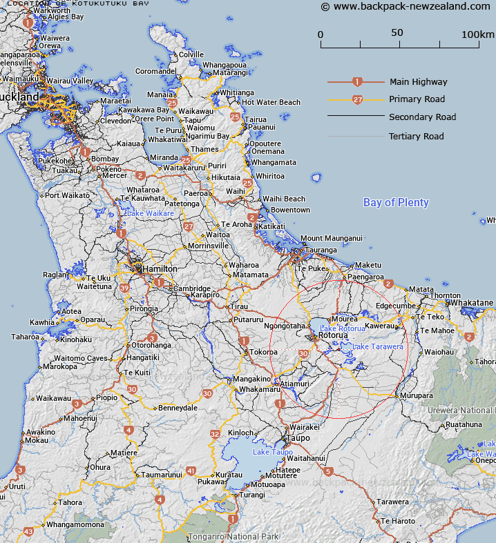
Map showing location of Kōtukutuku Bay


LINZ description: Located on the western shore of Lake Tarawera. NZMS260 U16 062275.
Latitude: -38.206219
Longitude: 176.380425
Northing: 5765900
Easting: 1896000
Land District: South Auckland
Feat Type: Bay


Scroll down to see a more detailed road map and below that a topographical map showing the location of Kōtukutuku Bay. The road map has been supplied by openstreetmap and the topographical map of Kōtukutuku Bay has been supplied by Land Information New Zealand (LINZ).

Yes you can use the top static map for you school/university project or personal website with a link back. Contact me for any commercial use.

Kōtukutuku Bay Map New Zealand


New Zealand places in our database
[ A ] [ B ] [ C ] [ D ] [ E ] [ F ] [ G ] [ H ] [ I ] [ J ] [ K ] [ L ] [ M ] [ N ] [ O ] [ P ] [ Q ] [ R ] [ S ] [ T ] [ U ] [ V ] [ W ] [ X ] [ Y ] [ Z ]


Closest 20 Bays to Kōtukutuku Bay

Rangiuru Bay ( 1.84km )   Hawaiki Bay ( 1.87km )   Rahuiroa Bay ( 2.63km )   R?huiroa Bay ( 2.63km )   Te H?nau Bay ( 2.97km )   Te Hirau Bay ( 2.97km )   Waitangi Bay ( 3.04km )   Te Karamea Bay ( 3.84km )   Mour? Bay ( 4.77km )   Te Pana Bay ( 6.33km )   Te Puna Bay ( 6.33km )   Te R?t? Bay ( 6.6km )   Haumingi Bay ( 6.71km )   Kanaehapa Bay ( 6.75km )   Kaiteriria Bay ( 6.81km )   Ng?heret? Bay ( 6.92km )   Otangimoana Bay ( 7.34km )   ?tangimoana Bay ( 7.34km )   Rapatu Bay ( 7.41km )   R?patu Bay ( 7.41km )   ?ruaroa Bay ( 7.84km )   Ruak?p? Bay ( 8.64km )   Kaik?kahi Bay ( 8.74km )   Kaikakahi Bay ( 8.74km )   Paremata Bay ( 9.22km )   Parimata Bay ( 9.22km )   Waikerer? Bay ( 9.72km )   Waikereru Bay ( 9.72km )   Te Tapahoro Bay ( 10.23km )   Kaiwaka Bay ( 10.64km )   Log Pool ( 11.42km )   Tahunap? Bay ( 11.54km )   Tahunapo Bay ( 11.54km )   Ng?hau? Bay ( 11.75km )   Tauranganui Bay ( 12.11km )   ?whatiura Bay ( 12.2km )   Holdens Bay ( 12.27km )   Waingaehe/Holdens Bay ( 12.27km )   Hannahs Bay ( 12.4km )   Waikawau/Hannahs Bay ( 12.4km )