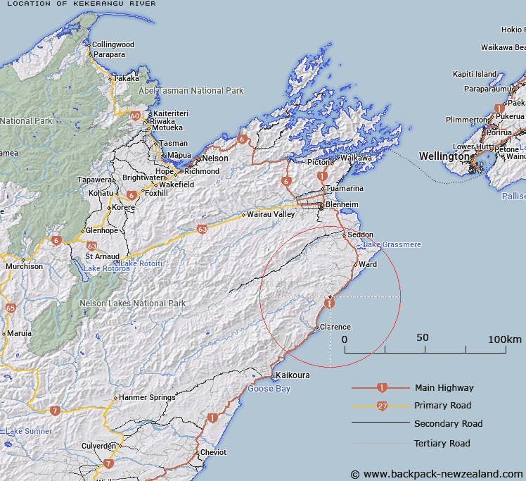
Map showing location of Kekerangu River


LINZ description: River with it's source below Whernside Peak, and Iwitahi Ridge, flowing Southwest into the Pacific Ocean at Kekerengu. Whernside Survey District.
Latitude: -41.990847
Longitude: 173.999236
Northing: 5350757.2
Easting: 1682766.7
Land District: Marlborough
Feat Type: Stream


Scroll down to see a more detailed road map and below that a topographical map showing the location of Kekerangu River. The road map has been supplied by openstreetmap and the topographical map of Kekerangu River has been supplied by Land Information New Zealand (LINZ).

Yes you can use the top static map for you school/university project or personal website with a link back. Contact me for any commercial use.

Kekerangu River Map New Zealand


New Zealand places in our database
[ A ] [ B ] [ C ] [ D ] [ E ] [ F ] [ G ] [ H ] [ I ] [ J ] [ K ] [ L ] [ M ] [ N ] [ O ] [ P ] [ Q ] [ R ] [ S ] [ T ] [ U ] [ V ] [ W ] [ X ] [ Y ] [ Z ]


Closest 20 Streams to Kekerangu River

Kekerangu River ( 0km )   Kekerengu River ( 0km )   Floodgate Stream ( 1.99km )   Snoutfield ( 2.54km )   Briny Brook ( 2.54km )   Valhalla Creek ( 2.54km )   Glencoe Stream ( 2.56km )   Ben More Stream ( 4.09km )   Boundary Stream ( 5.15km )   Tirohanga Stream ( 5.28km )   Paton Stream ( 6.55km )   Deadman Stream ( 7.15km )   Cutterig Stream ( 8.57km )   Burnt Stream ( 8.97km )   Pikes Creek ( 9.02km )   Woodside Creek ( 9.03km )   Woodbank Stream ( 9.6km )   The Zoo ( 9.94km )   Cover Stream ( 10.35km )   Brian Boru Stream ( 10.59km )   Wharf Stream ( 10.61km )   Flags Creek ( 10.62km )   Nidd Stream ( 10.69km )   Isolation Creek ( 10.97km )   Ned Stream ( 11.34km )   Ouse Stream ( 12.05km )   Waima River ( 12.06km )   Ure River ( 12.06km )   Whitewash Stream ( 12.6km )   Washdyke Stream ( 12.77km )   Big Stream ( 12.77km )   Box Stream ( 13.5km )   Headache Stream ( 14.21km )   Kawauiti Stream ( 14.22km )   Horse Stream ( 14.5km )   Dunsandel Creek ( 15.17km )   Black Angel Stream ( 15.31km )   Gibson Stream ( 15.52km )   Mead Stream ( 15.76km )   Kawaunui Stream ( 15.77km )