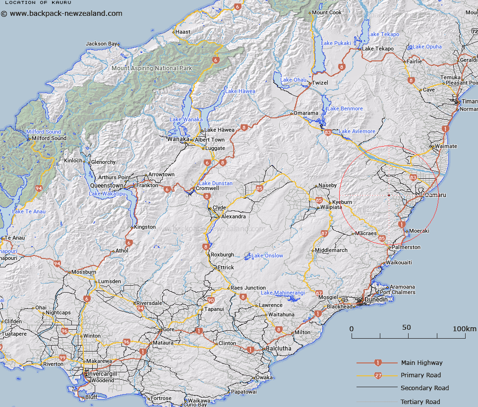
Map showing location of Kauru


LINZ description: Hill, 465m, 9km North-east of Mt Difficulty, and 5.5km North-west of Incholme locality. Kauru Survey District.
Latitude: -45.093107
Longitude: 170.709862
Northing: 5004155.1
Easting: 1419794.7
Land District: Otago
Feat Type: Hill


Scroll down to see a more detailed road map and below that a topographical map showing the location of Kauru. The road map has been supplied by openstreetmap and the topographical map of Kauru has been supplied by Land Information New Zealand (LINZ).

Yes you can use the top static map for you school/university project or personal website with a link back. Contact me for any commercial use.

Kauru Map New Zealand


New Zealand places in our database
[ A ] [ B ] [ C ] [ D ] [ E ] [ F ] [ G ] [ H ] [ I ] [ J ] [ K ] [ L ] [ M ] [ N ] [ O ] [ P ] [ Q ] [ R ] [ S ] [ T ] [ U ] [ V ] [ W ] [ X ] [ Y ] [ Z ]


Closest 20 Hills to Kauru

Black Cap ( 7.56km )   Obelisk ( 8.62km )   Crown Hill ( 8.95km )   Mount Difficulty ( 9.12km )   Mole Hill ( 9.26km )   Old Man ( 9.55km )   Scout Hill ( 10.04km )   Victoria Hill ( 10.37km )   Belmont Hill ( 10.59km )   Rakis Table ( 11.06km )   Round Hill ( 11.12km )   Survey Peak ( 12.4km )   Trig Island ( 13.49km )   Pukekarara ( 14.27km )   Government Hill ( 14.46km )   Sebastopol Hill ( 14.48km )   Island Cliff ( 14.57km )   Cliffords Table ( 14.57km )   Taipo ( 15.69km )   Little Table Hill ( 16.04km )   Siberia Hill ( 16.14km )   Mount Charles ( 16.6km )   Flat Top Hill ( 16.69km )   Fern Hill ( 16.89km )   Devils Elbow ( 17km )   Mount Stalker ( 17.8km )   Round Knob ( 17.84km )   Kattothryst ( 17.89km )   Mount Dasher ( 18.68km )   Division Hill ( 18.69km )   Table Hill ( 18.75km )   Devils Bridge ( 19.06km )   Mount Evelyn ( 19.32km )   Picnic Hill ( 19.36km )   Rams Head ( 19.59km )   Brockmans Hill ( 20.2km )   Mount Miserable ( 20.53km )   Prominent Peak ( 21.03km )   Big Hill ( 21.03km )   Table Top Hill ( 21.11km )