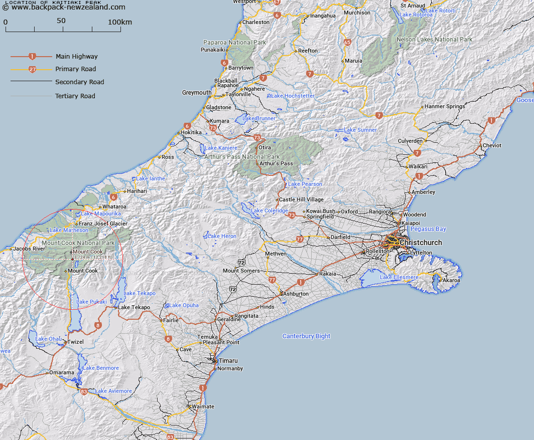
Map showing location of Kaitiaki Peak


LINZ description: Peak at height 2222m, located in the Mount Cook Range above Ball Pass, Aoraki/Mount Cook.
Latitude: -43.645462
Longitude: 170.153436
Northing: 5163565.9
Easting: 1370420
Land District: Canterbury
Feat Type: Hill


Scroll down to see a more detailed road map and below that a topographical map showing the location of Kaitiaki Peak. The road map has been supplied by openstreetmap and the topographical map of Kaitiaki Peak has been supplied by Land Information New Zealand (LINZ).

Yes you can use the top static map for you school/university project or personal website with a link back. Contact me for any commercial use.

Kaitiaki Peak Map New Zealand


New Zealand places in our database
[ A ] [ B ] [ C ] [ D ] [ E ] [ F ] [ G ] [ H ] [ I ] [ J ] [ K ] [ L ] [ M ] [ N ] [ O ] [ P ] [ Q ] [ R ] [ S ] [ T ] [ U ] [ V ] [ W ] [ X ] [ Y ] [ Z ]


Closest 20 Hills to Kaitiaki Peak

Turner Peak ( 0.85km )   Proud Peak ( 0.99km )   Mount Rosa ( 1km )   Mount Mabel ( 1.47km )   Pibrac ( 1.61km )   Nazomi ( 2.73km )   Mount Kinsey ( 4.15km )   Edith Peak ( 4.22km )   Low Peak ( 4.24km )   Raureka Peak ( 4.53km )   Anzac Peaks ( 4.71km )   Middle Peak ( 4.76km )   Lean Peak ( 4.84km )   Mount Beatrice ( 5.33km )   Madonna ( 5.41km )   Dilemma Peak ( 5.49km )   Aoraki/Mount Cook ( 5.65km )   Mount Cook ( 5.65km )   High Peak ( 5.68km )   North Peak ( 5.68km )   Mount Wakefield ( 5.76km )   Unicorn ( 5.94km )   Du Faur Peak ( 5.95km )   Mount Dampier ( 6.32km )   Mount Hicks (Saint Davids Dome) ( 6.72km )   Vancouver Mountain ( 6.78km )   Beatty Peak ( 6.96km )   Sturdee Peak ( 6.96km )   La Perouse ( 6.96km )   Jellicoe Peak ( 7km )   The Armchair ( 7km )   Cadogan Peak ( 7.02km )   Lowe Mountain ( 7.08km )   Low Mountain ( 7.08km )   Sibyl Peak ( 7.21km )   The Twins ( 7.49km )   Malaspina ( 7.49km )   Novara Peak ( 7.67km )   The Footstool ( 7.95km )   Glacier Dome ( 7.97km )