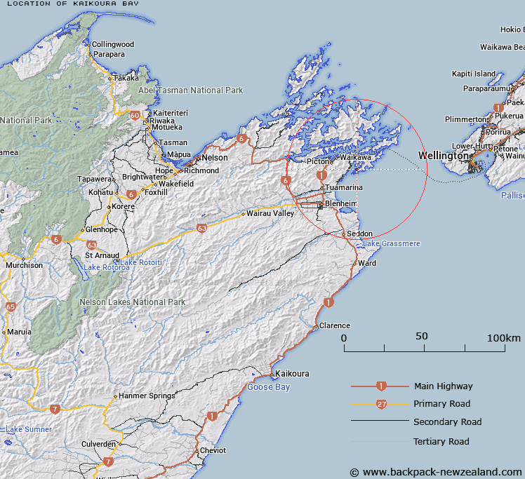
Map showing location of Kaikoura Bay


LINZ description: North west facing bay in Port Underwood, west of Whataroa Bay and opposite Tongue Bay.
Latitude: -41.327941
Longitude: 174.149562
Northing: 5424200
Easting: 1696200
Land District: Marlborough
Feat Type: Bay


Scroll down to see a more detailed road map and below that a topographical map showing the location of Kaikoura Bay. The road map has been supplied by openstreetmap and the topographical map of Kaikoura Bay has been supplied by Land Information New Zealand (LINZ).

Yes you can use the top static map for you school/university project or personal website with a link back. Contact me for any commercial use.

Kaikoura Bay Map New Zealand


New Zealand places in our database
[ A ] [ B ] [ C ] [ D ] [ E ] [ F ] [ G ] [ H ] [ I ] [ J ] [ K ] [ L ] [ M ] [ N ] [ O ] [ P ] [ Q ] [ R ] [ S ] [ T ] [ U ] [ V ] [ W ] [ X ] [ Y ] [ Z ]


Closest 20 Bays to Kaikoura Bay

Whataroa Bay ( 0.75km )   Pipi Bay ( 1.11km )   Karaka Bay ( 1.56km )   Whangatoetoe Bay ( 1.58km )   Tongue Bay ( 1.63km )   Jerdans Bay ( 1.95km )   Cutters Bay ( 2.42km )   Tumbledown Bay ( 2.58km )   Kingfish Bay ( 2.64km )   Port Underwood ( 2.69km )   Te Whanganui / Port Underwood ( 2.69km )   Uruti Bay ( 3.1km )   Deep Bight ( 3.11km )   Waingaro Bay ( 3.26km )   Coles Bay ( 3.26km )   Tom Canes Bay ( 3.36km )   Kanae Bay ( 3.47km )   Kakapo Bay ( 3.49km )   Waipuna Bay ( 3.5km )   Oyster Bay ( 3.95km )   Ocean Bay ( 4.11km )   Hakahaka Bay ( 4.28km )   Whangakoko Bay ( 4.36km )   ?raumoa / Fighting Bay ( 4.45km )   Fighting Bay (Oraumoa) ( 4.45km )   Oraumoa Bay ( 4.45km )   Hakana Bay ( 4.5km )   Whangataura Bay ( 4.7km )   Opihi Bay ( 4.75km )   Rangitane Bay ( 4.9km )   Ngakuta Bay ( 5.02km )   Waikutakuta / Robin Hood Bay ( 7.15km )   Robin Hood Bay ( 7.15km )   Opua Bay ( 7.6km )   Missionary Bay ( 7.62km )   Hitaua Bay ( 7.76km )   Maraetai Bay ( 8km )   Island Bay ( 8.13km )   Glasgow Bay ( 8.13km )   Tawa Bay ( 8.27km )