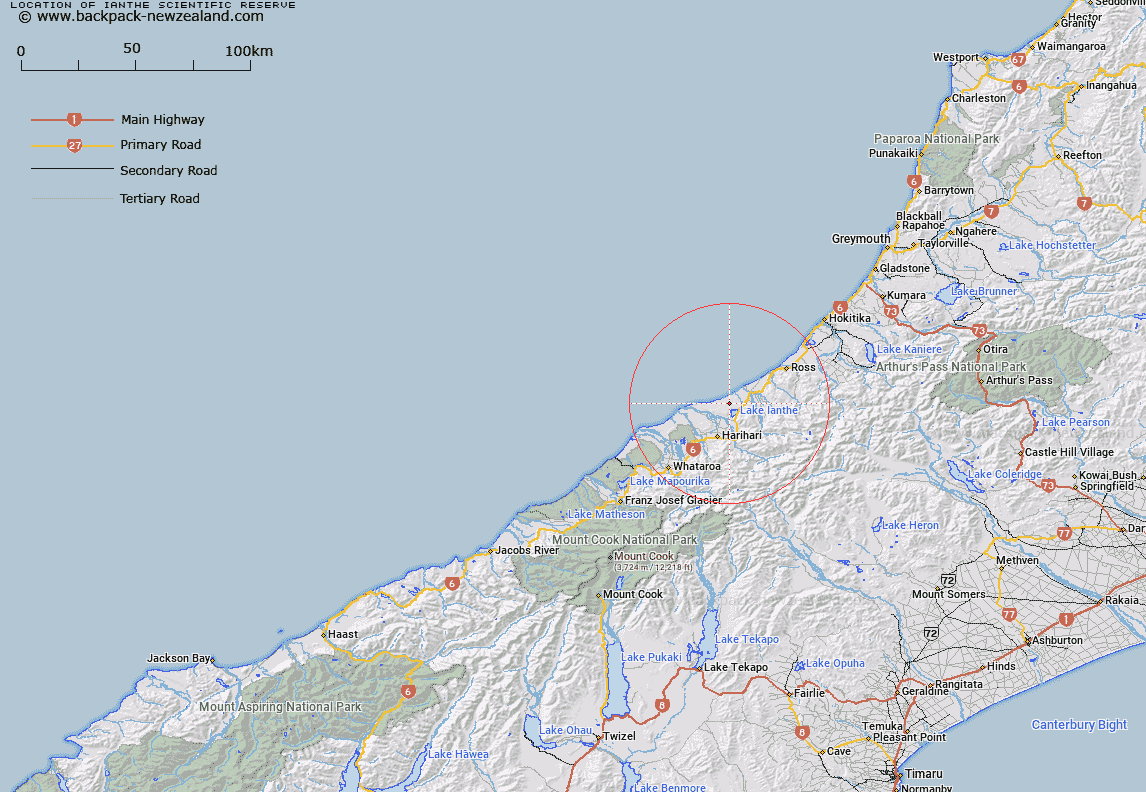
Map showing location of Ianthe Scientific Reserve


LINZ description: Scientific Reserve with an area of 2.1kmĀ², located approximately 45km south-west of Hokitika. Near Lake Ianthe/Matahi.
Latitude: -43.025278
Longitude: 170.600833
Northing: 5233584.8
Easting: 1404524
Land District: Westland
Feat Type: Scientific Reserve


Scroll down to see a more detailed road map and below that a topographical map showing the location of Ianthe Scientific Reserve. The road map has been supplied by openstreetmap and the topographical map of Ianthe Scientific Reserve has been supplied by Land Information New Zealand (LINZ).

Yes you can use the top static map for you school/university project or personal website with a link back. Contact me for any commercial use.

Ianthe Scientific Reserve Map New Zealand


New Zealand places in our database
[ A ] [ B ] [ C ] [ D ] [ E ] [ F ] [ G ] [ H ] [ I ] [ J ] [ K ] [ L ] [ M ] [ N ] [ O ] [ P ] [ Q ] [ R ] [ S ] [ T ] [ U ] [ V ] [ W ] [ X ] [ Y ] [ Z ]


Closest 20 Scientific Reserves to Ianthe Scientific Reserve

Enys Scientific Reserve ( 94.28km )   Lake Tekapo Scientific Reserve ( 112.3km )   Pukaki Scientific Reserve ( 128.54km )   Eyrewell Scientific Reserve ( 135.15km )   Bankside Scientific Reserve ( 148.4km )   Bendhu Scientific Reserve ( 165.08km )   Medbury Scientific Reserve ( 170.42km )   Waihora Scientific Reserve ( 179.16km )   Kaitorete Spit Scientific Reserve ( 183.12km )   Culverden Scientific Reserve ( 188.21km )   White Creek Fault Scientific Reserve ( 191.14km )   Lagoon Creek Scientific Reserve ( 209.4km )   Mata-au Scientific Reserve ( 220.56km )   Locharburn Scientific Reserve ( 230.92km )   Mahaka Katia Scientific Reserve ( 237.42km )   Chapman Road Scientific Reserve ( 268.59km )   Shag Point Scientific Reserve ( 272.01km )   Shag Point/Matakaea Scientific Reserve ( 272.01km )   Blue Duck Scientific Reserve ( 274.83km )   Black Rock Scientific Reserve ( 309.47km )   Waiora Scientific Reserve ( 310.68km )   Every's Scientific Reserve ( 313.88km )   Kokorua Open Scientific Reserve ( 322.88km )   Chancet Rocks Scientific Reserve ( 323.36km )   Muritai Scientific Reserve ( 330.06km )   Burwood Bush (Red Tussock) Scientific Reserve ( 343.85km )   Burwood (Takah? Rearing Site) Scientific Reserve ( 347.01km )   Tom Shand Scientific Reserve ( 351.06km )   The Wilderness Area Scientific Reserve ( 354.49km )   Te Anau Geological Reserve ( 355.74km )   Pukerau Red Tussock Scientific Reserve ( 362.23km )   Otapiri Scientific Reserve ( 367.52km )   Otanomomo Scientific Reserve ( 370.18km )   Sinclair Head Scientific Reserve ( 386.11km )   Red Rocks Scientific Reserve ( 387.12km )   Borland Mire Scientific Reserve ( 390.97km )   Lake Kohangapiripiri Wildlife Reserve ( 396.74km )   Lake Kohangatera and Lake Kohangapiripiri Scientific Reserve ( 396.74km )   Turakirae Head Scientific Reserve ( 397.98km )   Tahakopa Peat Dome Scientific Reserve ( 400.81km )