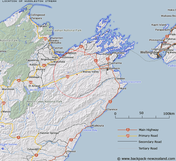
Map showing location of Huddleston Stream


LINZ description: Tributary of Excell Stream, crossing the stated highway fronting Mr Huddleston's property before joining with Excell Stream.
Latitude: -41.603942
Longitude: 173.455471
Northing: 5394095.9
Easting: 1637954.1
Land District: Marlborough
Feat Type: Stream


Scroll down to see a more detailed road map and below that a topographical map showing the location of Huddleston Stream. The road map has been supplied by openstreetmap and the topographical map of Huddleston Stream has been supplied by Land Information New Zealand (LINZ).

Yes you can use the top static map for you school/university project or personal website with a link back. Contact me for any commercial use.

Huddleston Stream Map New Zealand


New Zealand places in our database
[ A ] [ B ] [ C ] [ D ] [ E ] [ F ] [ G ] [ H ] [ I ] [ J ] [ K ] [ L ] [ M ] [ N ] [ O ] [ P ] [ Q ] [ R ] [ S ] [ T ] [ U ] [ V ] [ W ] [ X ] [ Y ] [ Z ]


Closest 20 Streams to Huddleston Stream

Huddleston Stream ( 0km )   Andersons Floodway ( 2.69km )   Excell Stream ( 3.4km )   Walkers Stream ( 4.24km )   Hillersden Stream ( 5.6km )   Boundary Creek ( 5.81km )   Kaka Stream ( 5.93km )   Quartz Creek ( 5.99km )   Burnt Scrub Creek ( 6.12km )   Big Haycock Stream ( 6.56km )   Wantwood Creek ( 6.72km )   Enchanted Stream ( 7.64km )   Burnt Creek ( 7.92km )   Sweets Stream ( 8.05km )   Dismal Stream ( 8.2km )   Blue Bell Creek ( 8.47km )   Little Haycock Stream ( 8.83km )   Scheelite Creek ( 8.88km )   Davis Creek ( 8.93km )   Staircase Stream ( 9.07km )   Boundary Creek ( 9.44km )   Timms Creek ( 9.66km )   Top Valley Stream ( 9.82km )   Noel Stream ( 9.99km )   Brothers Stream ( 10.03km )   Turners Creek ( 10.1km )   Quartz Creek ( 10.16km )   Cat Creek ( 10.3km )   Jacksons Creek ( 10.32km )   Netherwood Stream ( 10.43km )   Bluff Creek ( 10.81km )   Armchair Stream ( 10.92km )   Kiernan Creek ( 11.21km )   Flaxmill Creek ( 11.74km )   Wye Hill Stream ( 12.25km )   Wye River ( 12.37km )   Waihopai River ( 12.41km )   Back Range Stream ( 12.56km )   Pine Valley Stream ( 12.78km )   Byron Stream ( 13.06km )