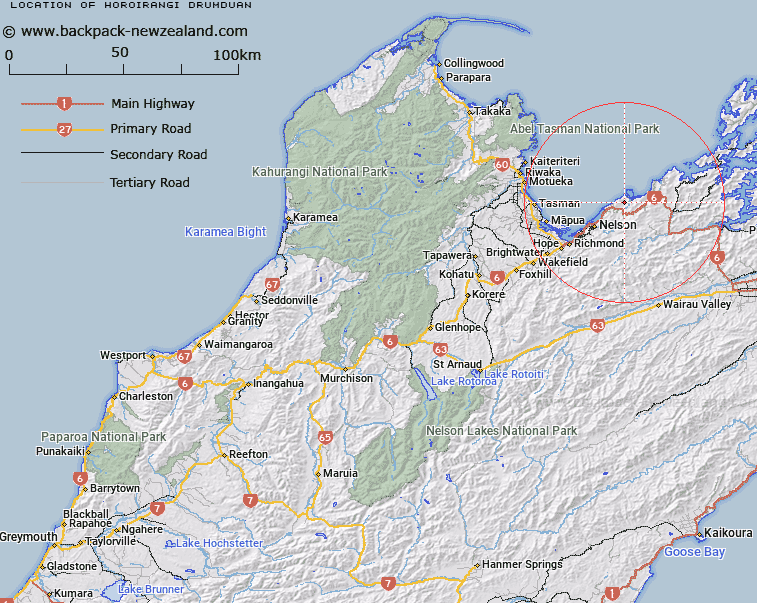
Map showing location of Horoirangi / Drumduan


LINZ description: A hill at 657 m east of Glenduan approximately 14 km northeast of Nelson City. Feature shown on: NZMS260 O27 Edition 2 1994; NZTopo50-BQ26 334407.
Latitude: -41.184167
Longitude: 173.397944
Northing: 5440722
Easting: 1633374.4
Land District: Nelson
Feat Type: Hill


Scroll down to see a more detailed road map and below that a topographical map showing the location of Horoirangi / Drumduan. The road map has been supplied by openstreetmap and the topographical map of Horoirangi / Drumduan has been supplied by Land Information New Zealand (LINZ).

Yes you can use the top static map for you school/university project or personal website with a link back. Contact me for any commercial use.
Horoirangi / Drumduan Map New Zealand


New Zealand places in our database
[ A ] [ B ] [ C ] [ D ] [ E ] [ F ] [ G ] [ H ] [ I ] [ J ] [ K ] [ L ] [ M ] [ N ] [ O ] [ P ] [ Q ] [ R ] [ S ] [ T ] [ U ] [ V ] [ W ] [ X ] [ Y ] [ Z ]


Closest 20 Hills to Horoirangi / Drumduan

Sentinel Hill ( 2.72km )   Stuart Hill ( 4.49km )   Blue Hill ( 4.57km )   Wells Hill ( 7.8km )   Gentle Annie ( 7.95km )   Mount Duppa ( 9.15km )   Saddle Hill ( 10.55km )   K?k? Hill ( 10.86km )   Maunganui ( 10.95km )   Botanical Hill ( 12.84km )   Sharland Hill ( 13.72km )   Pikimai / Church Hill ( 13.96km )   Red Hill ( 14.72km )   Mount Victoria ( 15.06km )   Sugar Loaf ( 15.36km )   Maungatapu ( 15.5km )   Fringed Hill ( 15.61km )   Mount Barrett ( 15.87km )   South Castor Peak ( 16km )   North Castor Peak ( 16.04km )   Grampians ( 16.06km )   Little Twin ( 16.91km )   Wooded Peak ( 17.35km )   M?nuka Hill ( 17.36km )   Dun Mountain ( 17.68km )   Croisilles Peak ( 18.44km )   Croixelles Peak ( 18.44km )   Teranga ( 18.59km )   Mount Rimu ( 18.98km )   Jenkins Hill ( 19.08km )   Blue Knob ( 19.39km )   Charleys Head ( 19.42km )   Mount Ronga ( 19.55km )   Mount Claude ( 19.94km )   Camp Hill ( 20.09km )   Bush Hill ( 20.12km )   The Rocks ( 21.38km )   Goat Hill ( 21.96km )   Elliott Peak ( 22.22km )   Elliot Peak ( 22.22km )