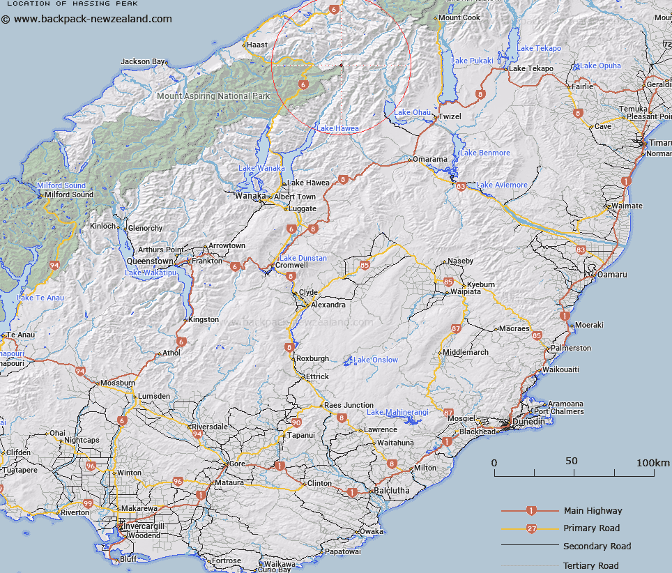
Map showing location of Hassing Peak


LINZ description: Peak at the head of the Hunter and Willis Rivers east of Mount Marshman in the Bealey Range of the Southern Alps/Kā Tiritiri o te Moana.
Latitude: -43.984802
Longitude: 169.577044
Northing: 5124117.2
Easting: 1325491.5
Land District: Otago
Feat Type: Hill


Scroll down to see a more detailed road map and below that a topographical map showing the location of Hassing Peak. The road map has been supplied by openstreetmap and the topographical map of Hassing Peak has been supplied by Land Information New Zealand (LINZ).

Yes you can use the top static map for you school/university project or personal website with a link back. Contact me for any commercial use.

Hassing Peak Map New Zealand


New Zealand places in our database
[ A ] [ B ] [ C ] [ D ] [ E ] [ F ] [ G ] [ H ] [ I ] [ J ] [ K ] [ L ] [ M ] [ N ] [ O ] [ P ] [ Q ] [ R ] [ S ] [ T ] [ U ] [ V ] [ W ] [ X ] [ Y ] [ Z ]


Closest 20 Hills to Hassing Peak

Mount Marshman ( 0.62km )   Docherty Peak ( 1km )   Watkins Dome ( 2.33km )   Mount Greenfield ( 2.68km )   Shingle Top ( 2.71km )   Mount Tylee ( 3.11km )   Mount Napoleon ( 3.31km )   Mount Holdsworth ( 3.32km )   Mount Awkward ( 3.66km )   Square Top ( 3.75km )   Wills Peak ( 3.99km )   Mount Maitland ( 4.77km )   Mount Pearson ( 5.01km )   Mount Giles ( 5.49km )   Mount Enderby ( 5.6km )   Snow Top ( 5.96km )   Mount Bull ( 6.18km )   Adams Peak ( 6.36km )   Mount Wilson ( 8.04km )   Mount Lakeman ( 8.13km )   Clarkes Mound ( 8.67km )   Clarke Mound ( 8.67km )   Mount Earle ( 9.06km )   Mount Ferguson ( 9.46km )   Mount Tole ( 9.54km )   Mount Good ( 9.68km )   Mount Strauchon ( 9.91km )   Mount Hammerack ( 9.93km )   Mount Wray ( 10.18km )   Mount Ramsay ( 10.39km )   Anita Peak ( 10.46km )   Protuberance Peak ( 10.49km )   College Peak ( 10.68km )   Birch Knob ( 11.03km )   Stevenson Peak ( 11.5km )   Soloist Peak ( 11.6km )   Mount Solution ( 11.63km )   Abseil Peak ( 11.68km )   Chosspile Peaks ( 12.38km )   Mount Mackenzie ( 12.41km )