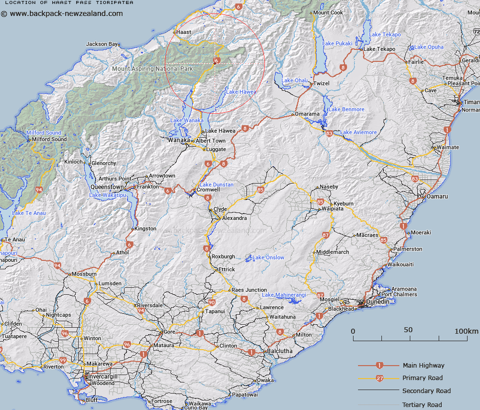
Map showing location of Haast Pass/Tioripatea


LINZ description: Feature shown on: NZMS260-G38 183715; NZTopo50-BZ13 083098;
Latitude: -44.107234
Longitude: 169.354799
Northing: 5109753.4
Easting: 1308269.8
Land District: Otago, Westland
Feat Type: Pass


Scroll down to see a more detailed road map and below that a topographical map showing the location of Haast Pass/Tioripatea. The road map has been supplied by openstreetmap and the topographical map of Haast Pass/Tioripatea has been supplied by Land Information New Zealand (LINZ).

Yes you can use the top static map for you school/university project or personal website with a link back. Contact me for any commercial use.
Haast Pass/Tioripatea Map New Zealand


New Zealand places in our database
[ A ] [ B ] [ C ] [ D ] [ E ] [ F ] [ G ] [ H ] [ I ] [ J ] [ K ] [ L ] [ M ] [ N ] [ O ] [ P ] [ Q ] [ R ] [ S ] [ T ] [ U ] [ V ] [ W ] [ X ] [ Y ] [ Z ]


Closest 20 Passs to Haast Pass/Tioripatea

Haast Pass/Tioripatea ( 0km )   Haast Pass ( 0km )   Douglas Saddle ( 12.01km )   Topsey Saddle ( 12.37km )   Mueller Pass ( 12.78km )   Mac Saddle ( 14.32km )   The Gateway ( 15.4km )   Wills Pass ( 16.36km )   Maori Saddle ( 16.45km )   Emily Pass ( 17.73km )   Mistaken Saddle ( 20.02km )   Wilson Pass ( 22.64km )   Upper Studholme Pass ( 23.01km )   Gillespie Pass ( 23.33km )   Lower Studholme Pass ( 23.68km )   Governors Pass ( 23.68km )   Siberia Saddle ( 26.18km )   Turnbull Pass ( 27.37km )   V Notch Pass ( 27.82km )   Stewart Pass ( 29.86km )   Newland Pass ( 31.14km )   Gunbarrel Pass ( 32.84km )   Gunsight Pass ( 32.84km )   Te Naihi Pass ( 32.94km )   Te Naihi Saddle ( 32.94km )   Maori Saddle ( 33.17km )   Brodrick Pass ( 33.47km )   Clarke Pass ( 34.24km )   Fraser Col ( 37.88km )   The Neck ( 38.73km )   Surveyors Col ( 38.98km )   Chloe Col ( 40.16km )   Lower Otoko Pass ( 40.3km )   Harker Col ( 42.28km )   Upper Otoko Pass ( 42.79km )   Chasm Pass ( 43.4km )   Elcho Pass ( 44.3km )   McGloin Pass ( 45.93km )   Rabbit Pass ( 46.3km )   Pearson Saddle ( 46.47km )