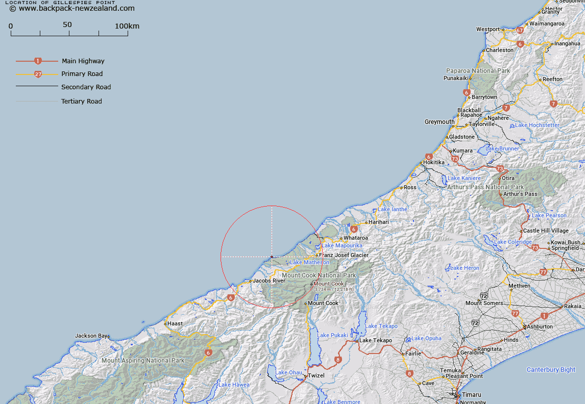
Map showing location of Gillespies Point


LINZ description: Feature shown on: NZMS260-H35 542520; NZTopo50-BW14ptBX14 442903;
Latitude: -43.396556
Longitude: 169.841374
Northing: 5190300
Easting: 1344200
Land District: Westland
Feat Type: Point


Scroll down to see a more detailed road map and below that a topographical map showing the location of Gillespies Point. The road map has been supplied by openstreetmap and the topographical map of Gillespies Point has been supplied by Land Information New Zealand (LINZ).

Yes you can use the top static map for you school/university project or personal website with a link back. Contact me for any commercial use.

Gillespies Point Map New Zealand


New Zealand places in our database
[ A ] [ B ] [ C ] [ D ] [ E ] [ F ] [ G ] [ H ] [ I ] [ J ] [ K ] [ L ] [ M ] [ N ] [ O ] [ P ] [ Q ] [ R ] [ S ] [ T ] [ U ] [ V ] [ W ] [ X ] [ Y ] [ Z ]


Closest 20 Points to Gillespies Point

Galway Point ( 4.32km )   Otorokua Point ( 4.69km )   Makawhio Point ( 23.44km )   Heretaniwha Point ( 31.43km )   Rehder Head ( 33.18km )   Canoe Point ( 35.38km )   Burrough Head ( 37.61km )   Buttress Point ( 38.08km )   Point Niccolo ( 38.37km )   Kea Point ( 38.93km )   Stoney Point ( 40.29km )   Commissioner Point ( 40.89km )   Tititira Head ( 41.86km )   Awataikato Point ( 45.75km )   Abut Head ( 46.83km )   Piakatu Point ( 47.25km )   Tasman Point ( 48.8km )   Beachy Point ( 50.76km )   Black Point ( 51.09km )   Woodcutters Point ( 53.18km )   Snapper Point ( 54.73km )   Blue Point ( 55.11km )   Bloody Point ( 55.13km )   Micks Point ( 55.76km )   Otumotu Point ( 56.88km )   Knights Point ( 60.89km )   Wanganui Heads ( 61.07km )   Arnott Point ( 62.3km )   Seal Point ( 64.21km )   Tauperikaka Point ( 68.59km )   Mussel Point ( 97.01km )   Totara Point ( 99.59km )   Blacksmith Point ( 107.47km )   Hobart Point ( 109.44km )   Picnic Point ( 110.86km )   Blowing Point ( 113.22km )   Jackson Head ( 116.53km )   Windy Point ( 118.01km )   Smoothwater Point ( 118.67km )   Burmeister Point ( 120.23km )