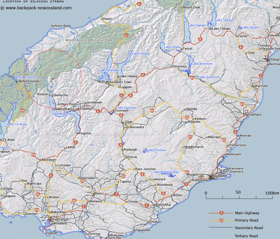
Map showing location of Gilkison Stream


LINZ description: Tributary of the Earnslaw Burn, with source at the southern end of and to the South of Earnslaw Glacier. Earnslaw Survey District.
Latitude: -44.639255
Longitude: 168.400248
Northing: 5046822.3
Easting: 1235196.3
Land District: Otago
Feat Type: Stream


Scroll down to see a more detailed road map and below that a topographical map showing the location of Gilkison Stream. The road map has been supplied by openstreetmap and the topographical map of Gilkison Stream has been supplied by Land Information New Zealand (LINZ).

Yes you can use the top static map for you school/university project or personal website with a link back. Contact me for any commercial use.

Gilkison Stream Map New Zealand


New Zealand places in our database
[ A ] [ B ] [ C ] [ D ] [ E ] [ F ] [ G ] [ H ] [ I ] [ J ] [ K ] [ L ] [ M ] [ N ] [ O ] [ P ] [ Q ] [ R ] [ S ] [ T ] [ U ] [ V ] [ W ] [ X ] [ Y ] [ Z ]


Closest 20 Streams to Gilkison Stream

Lennox Creek ( 4.06km )   Bedford Stream ( 4.98km )   Hunter Creek South Branch ( 5.35km )   Dundas Creek ( 5.83km )   Hunter Creek ( 5.83km )   Hunter Creek West Branch ( 6.82km )   Arthurs Creek ( 7.23km )   Earnslaw Burn ( 7.24km )   Rees River ( 7.45km )   Dart River ( 7.83km )   Dart River/Te Awa Whakatipu ( 7.83km )   River Jordan ( 8.41km )   Big Devil Creek ( 8.47km )   Hunter Creek North Branch ( 8.5km )   Slip Stream ( 8.87km )   Bridges Creek ( 8.98km )   Muddy Creek ( 9.15km )   Whatta Creek ( 9.18km )   Little Devil Creek ( 9.24km )   Twenty Five Mile Creek ( 9.44km )   Rough Creek ( 11.2km )   McBride Burn ( 11.56km )   Bride Burn ( 11.56km )   Rock Burn ( 11.75km )   Invincible Creek ( 12.37km )   Sugar Loaf Stream ( 12.38km )   Dredge Burn ( 12.41km )   McDougalls Creek ( 12.55km )   Margaret Burn ( 12.55km )   Rough Creek ( 12.72km )   Rough Creek ( 13.06km )   False Pass Burn ( 13.17km )   Route Burn ( 13.57km )   Double Barrel Creek ( 13.96km )   Pass Burn ( 14.29km )   Stair Creek ( 15.03km )   Lima Creek ( 15.12km )   Diamond Creek ( 15.24km )   Robertson Creek ( 15.4km )   Beans Burn ( 15.83km )