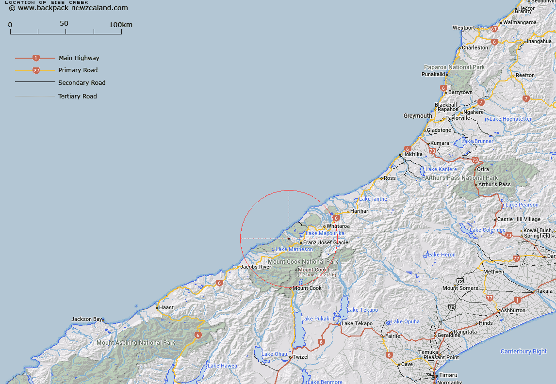
Map showing location of Gibb Creek


LINZ description: Stream flowing generally north-westerly along the Omoeroa Range, and into Onmoeroa River
Latitude: -43.353325
Longitude: 170.085369
Northing: 5195821.6
Easting: 1363793
Land District: Westland
Feat Type: Stream


Scroll down to see a more detailed road map and below that a topographical map showing the location of Gibb Creek. The road map has been supplied by openstreetmap and the topographical map of Gibb Creek has been supplied by Land Information New Zealand (LINZ).

Yes you can use the top static map for you school/university project or personal website with a link back. Contact me for any commercial use.

Gibb Creek Map New Zealand


New Zealand places in our database
[ A ] [ B ] [ C ] [ D ] [ E ] [ F ] [ G ] [ H ] [ I ] [ J ] [ K ] [ L ] [ M ] [ N ] [ O ] [ P ] [ Q ] [ R ] [ S ] [ T ] [ U ] [ V ] [ W ] [ X ] [ Y ] [ Z ]


Closest 20 Streams to Gibb Creek

Pug Creek ( 1.32km )   Docherty Creek ( 1.5km )   Smithy Creek ( 4.75km )   Neils Creek ( 4.77km )   Waiho River ( 5.72km )   Omoeroa River ( 5.9km )   Kiwi Jacks Creek ( 6.47km )   Molly Creek ( 6.78km )   Paddy Creek ( 6.9km )   Waikukupa River ( 7.38km )   Friends Creek ( 7.66km )   Jacks Creek ( 7.85km )   Ned Creek ( 8.03km )   Company Creek ( 8.28km )   Dolly Creek ( 9.23km )   Atupau Stream ( 9.42km )   Tatare Stream ( 9.42km )   Hauraki Creek ( 9.45km )   Blanchards Creek ( 9.46km )   Five Mile Creek ( 9.73km )   Hare Mare Creek ( 10.02km )   Octopus Creek ( 10.12km )   Stony Creek ( 10.16km )   Arthur Creek ( 10.29km )   Acrobat Creek ( 10.47km )   Potters Creek ( 10.66km )   Park Creek ( 10.7km )   Duck Creek ( 10.9km )   Frank Creek ( 10.98km )   Joey Creek ( 11.02km )   Trident Creek ( 11.19km )   Hugh Creek ( 11.34km )   Arch Creek ( 11.44km )   Lyttles Creek ( 11.45km )   Negative Creek ( 11.6km )   Cockabulla Creek ( 11.82km )   Waitapi Creek ( 11.97km )   Rope Creek ( 12.32km )   Carters Creek ( 12.7km )   Waipeka Creek ( 12.79km )