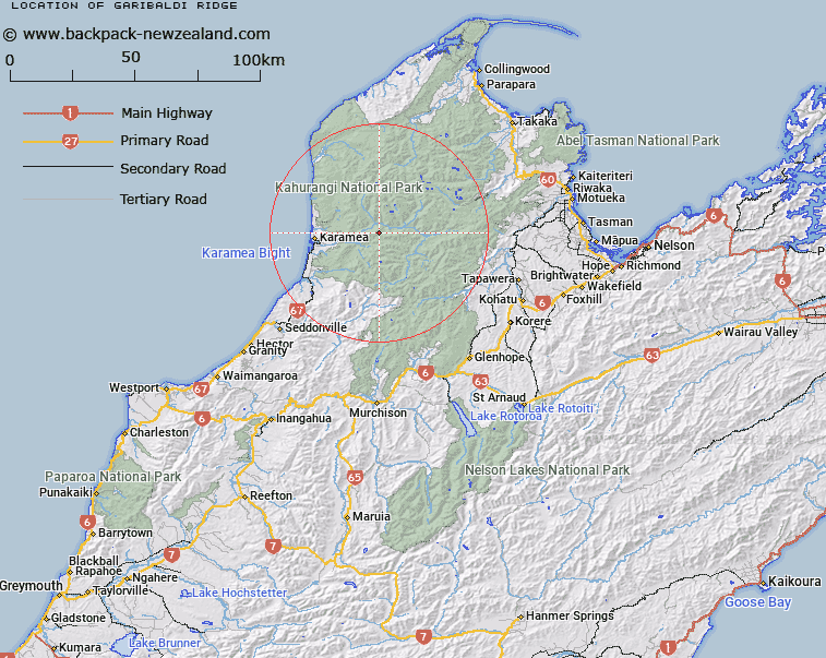
Map showing location of Garibaldi Ridge
LINZ description: Range of peaks running eastward from a point (1277m), 2.5km West South-west of Mount Garibaldi (Geodetic Code A6P6) through Mount Garibaldi and Pyramid Peak [Trig. E (Geodetic Code A6P7)] to Sandy Peak [Trig. B (Geodetic Code A6P3)]. Oparara and Leslie Survey Districts.
Latitude: -41.226965
Longitude: 172.33225
Northing: 5435832.3
Easting: 1544034.1
Land District: Nelson
Feat Type: Ridge
Latitude: -41.226965
Longitude: 172.33225
Northing: 5435832.3
Easting: 1544034.1
Land District: Nelson
Feat Type: Ridge

Scroll down to see a more detailed road map and below that a topographical map showing the location of Garibaldi Ridge. The road map has been supplied by openstreetmap and the topographical map of Garibaldi Ridge has been supplied by Land Information New Zealand (LINZ).
Yes you can use the top static map for you school/university project or personal website with a link back. Contact me for any commercial use.
[ A ] [ B ] [ C ] [ D ] [ E ] [ F ] [ G ] [ H ] [ I ] [ J ] [ K ] [ L ] [ M ] [ N ] [ O ] [ P ] [ Q ] [ R ] [ S ] [ T ] [ U ] [ V ] [ W ] [ X ] [ Y ] [ Z ]