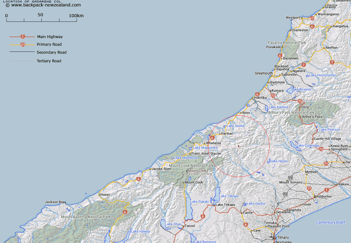
Map showing location of Gadarene Col


LINZ description: Pass 800m south of Mount Stoddart and between the Lambert and Malcolm Glaciers. Block XVII Butler Survey District.
Latitude: -43.294384
Longitude: 170.791026
Northing: 5204124.2
Easting: 1420809.4
Land District: Westland
Feat Type: Pass


Scroll down to see a more detailed road map and below that a topographical map showing the location of Gadarene Col. The road map has been supplied by openstreetmap and the topographical map of Gadarene Col has been supplied by Land Information New Zealand (LINZ).

Yes you can use the top static map for you school/university project or personal website with a link back. Contact me for any commercial use.

Gadarene Col Map New Zealand


New Zealand places in our database
[ A ] [ B ] [ C ] [ D ] [ E ] [ F ] [ G ] [ H ] [ I ] [ J ] [ K ] [ L ] [ M ] [ N ] [ O ] [ P ] [ Q ] [ R ] [ S ] [ T ] [ U ] [ V ] [ W ] [ X ] [ Y ] [ Z ]


Closest 20 Passs to Gadarene Col

Lambert Col ( 0.99km )   Malcolm Col ( 1.12km )   Rangitata Col ( 2.03km )   McCoy Col ( 3.12km )   Satan Saddle ( 5.02km )   Gladiator Col ( 5.82km )   Toledo Col ( 6.65km )   Battleaxe Col ( 7.48km )   Camp Saddle ( 7.61km )   Perth Col ( 7.76km )   Lucknow Saddle ( 7.76km )   Crossbow Saddle ( 8.13km )   Strachan Pass ( 8.35km )   Adams Col ( 8.8km )   Disappointment Saddle ( 9.42km )   Bandolero Col ( 9.55km )   Musterers Col ( 9.76km )   Havelock Col ( 9.98km )   Ambrose Saddle ( 10.17km )   Menace Gap ( 10.42km )   Angel Col ( 10.53km )   Veil Col ( 11.43km )   Orb Col ( 11.55km )   Fan Col ( 11.64km )   Iceland Col ( 12.04km )   Chowbok Col ( 12.51km )   Vertebrae Col ( 14.04km )   Full Moon Saddle ( 15.46km )   Erewhon Col ( 15.54km )   Red Lion Col ( 15.66km )   Gunn Pass ( 16.49km )   Whitcombe Pass ( 16.52km )   Cameron Col ( 16.69km )   McKenzie Col ( 16.81km )   Lawrence Col ( 16.93km )   Reischek Col ( 17.37km )   Jagged Col ( 18.76km )   Groove Col ( 19.4km )   Dennistoun Pass ( 19.46km )   Dummy Col ( 19.79km )