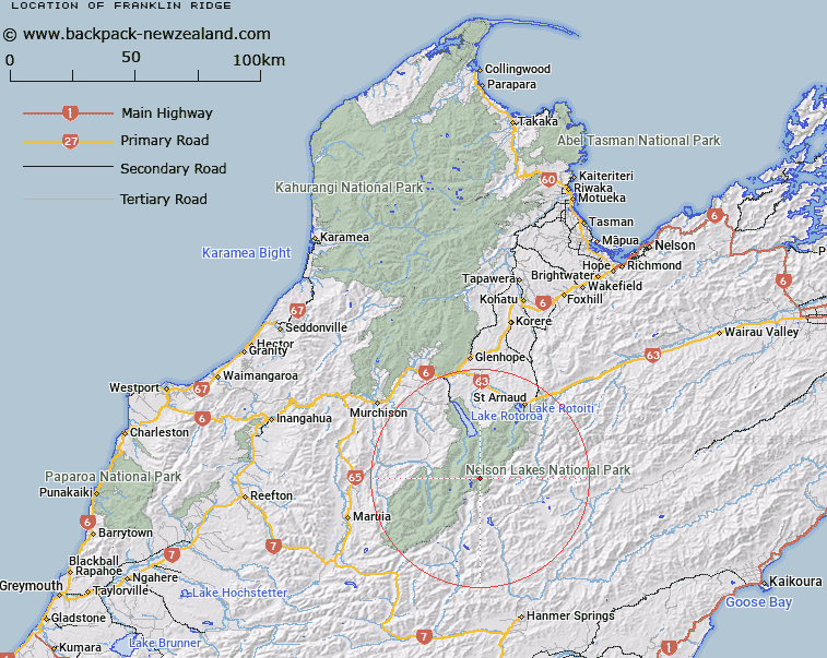
Map showing location of Franklin Ridge


LINZ description: Ridge running southward from the junction of the East and West Branches of the Sabine River, through Mount Franklin to peak 2200m in Spenser Mountains 4km East North-east of Mount Mahanga. Sabine Survey District.
Latitude: -42.054331
Longitude: 172.686028
Northing: 5344143.7
Easting: 1574019.7
Land District: Nelson
Feat Type: Ridge


Scroll down to see a more detailed road map and below that a topographical map showing the location of Franklin Ridge. The road map has been supplied by openstreetmap and the topographical map of Franklin Ridge has been supplied by Land Information New Zealand (LINZ).

Yes you can use the top static map for you school/university project or personal website with a link back. Contact me for any commercial use.

Franklin Ridge Map New Zealand


New Zealand places in our database
[ A ] [ B ] [ C ] [ D ] [ E ] [ F ] [ G ] [ H ] [ I ] [ J ] [ K ] [ L ] [ M ] [ N ] [ O ] [ P ] [ Q ] [ R ] [ S ] [ T ] [ U ] [ V ] [ W ] [ X ] [ Y ] [ Z ]


Closest 20 Ridges to Franklin Ridge

Turk Ridge ( 14.06km )   Fifteen Mile Spur ( 14.52km )   Angelus Ridge ( 16.66km )   Balaclava Ridge ( 18.74km )   Paget Ridge ( 19.73km )   Stafford Ridge ( 21km )   Robert Ridge ( 22.52km )   Three Sisters ( 23.5km )   Mangerton Ridge ( 23.57km )   Inkerman Ridge ( 23.74km )   Christie Ridge ( 23.79km )   Saw Spur ( 24.19km )   Prospect Ridge ( 24.68km )   Long Spur ( 26.4km )   Sebastopol Ridge ( 26.46km )   Cardigan Ridge ( 27.77km )   Pass Spur ( 28.16km )   The Battery ( 30.88km )   The Fingerpost ( 34.21km )   Saddle Spur ( 34.5km )   Blue Cliffs Ridge ( 45.67km )   The Burnt Spur ( 46.59km )   Newton Ridge ( 48.21km )   Razorback ( 48.72km )   Fandang Spur ( 49.5km )   Deepdale Ridge ( 52.1km )   Canterbury Spur ( 52.34km )   Porter Ridge ( 52.79km )   Red Hills Ridge ( 52.86km )   Fork Spur ( 52.89km )   Big Benledi ( 55.85km )   Bald Knob Ridge ( 57.29km )   The Horse Spur ( 58.58km )   Snowgrass Spur ( 58.66km )   Rough Spur ( 59.16km )   Conway Spur ( 60.34km )   Saint Bernard Spur ( 60.65km )   Ship Spur ( 60.99km )   Mount Horrible Spur ( 63.94km )   Whales Back ( 64.47km )