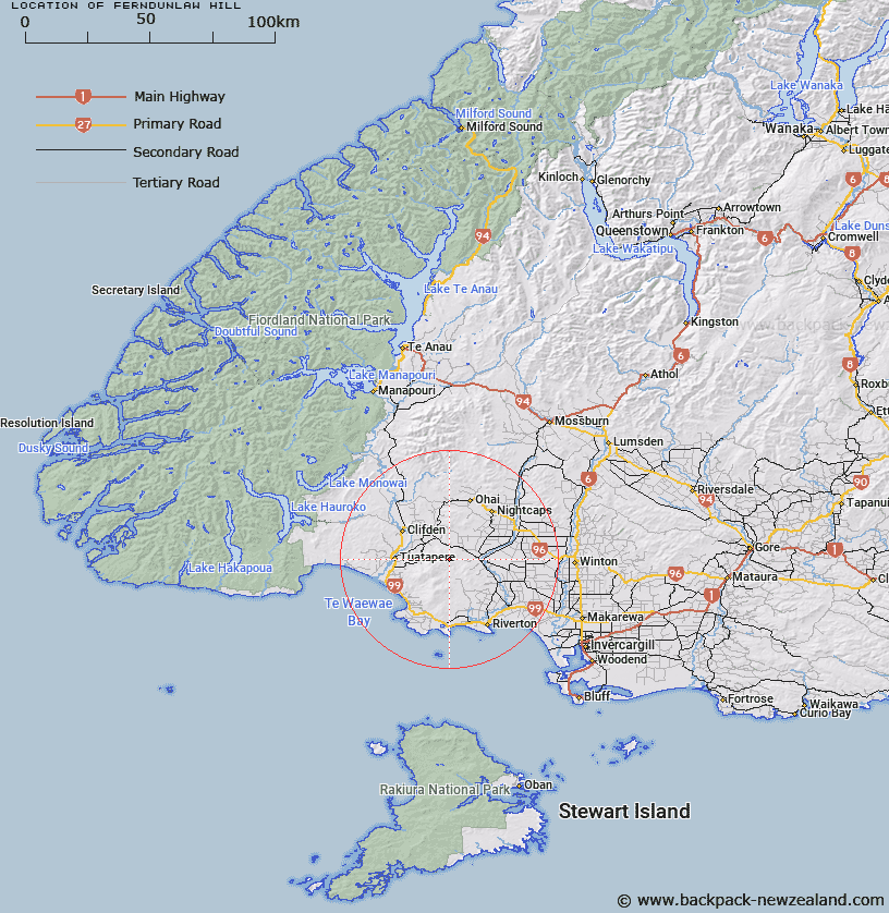
Map showing location of Ferndunlaw Hill


LINZ description: At 621m height in Longwood Forest south east of Merry Creek Otautau, north-west of Invercargill.
Latitude: -46.13154
Longitude: 167.883785
Northing: 4878600
Easting: 1204800
Land District: Southland
Feat Type: Hill


Scroll down to see a more detailed road map and below that a topographical map showing the location of Ferndunlaw Hill. The road map has been supplied by openstreetmap and the topographical map of Ferndunlaw Hill has been supplied by Land Information New Zealand (LINZ).

Yes you can use the top static map for you school/university project or personal website with a link back. Contact me for any commercial use.

Ferndunlaw Hill Map New Zealand


New Zealand places in our database
[ A ] [ B ] [ C ] [ D ] [ E ] [ F ] [ G ] [ H ] [ I ] [ J ] [ K ] [ L ] [ M ] [ N ] [ O ] [ P ] [ Q ] [ R ] [ S ] [ T ] [ U ] [ V ] [ W ] [ X ] [ Y ] [ Z ]


Closest 20 Hills to Ferndunlaw Hill

Ferndunlaw ( 0.04km )   Merrivale ( 4.8km )   Bald Hill ( 5.72km )   Pukemaori ( 9.44km )   Orawia ( 9.7km )   Scotts Gap ( 10.61km )   Pikopiko ( 12.43km )   Woodlaw ( 12.92km )   Longwood ( 13.48km )   Braida Crags ( 14.34km )   Pohatu ( 14.67km )   Eastern Bush ( 16.02km )   Wairio Hill ( 16.52km )   Twinlaw ( 17.12km )   Ngapari ( 17.42km )   Stucks Hill ( 17.49km )   Little Wairio Hill ( 18.38km )   Te Tumutu ( 18.6km )   Waimotu ( 18.78km )   Round Hill ( 19.39km )   The Downs ( 19.44km )   Reipihi ( 19.51km )   Papatotara ( 21.38km )   Otahu ( 21.38km )   Sharpridge ( 21.46km )   Masons Hill ( 22.61km )   The Nightcaps ( 23.54km )   Pahia Hill ( 25.35km )   Mount Franklin ( 25.4km )   Malakoff Hill ( 25.47km )   Wairaki ( 26.42km )   Mount Linton ( 26.77km )   Ruahine Hill ( 27.62km )   White Hill ( 27.71km )   Wether Hill ( 30.07km )   Midnight Hill ( 31.2km )   Loudon Hill ( 31.5km )   Beaumont Hill ( 31.73km )   Rocky Peak ( 32.1km )   Gibraltar Hill ( 33.03km )