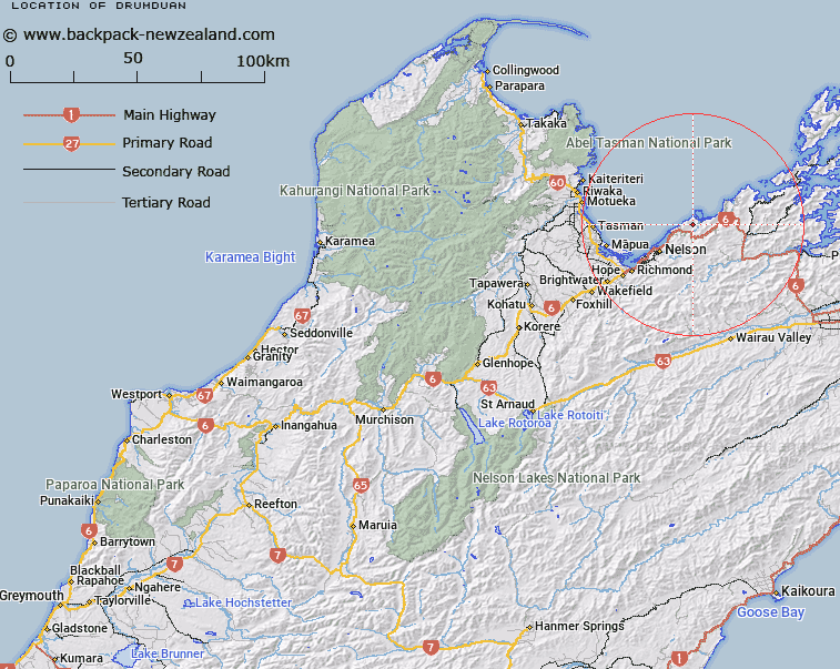
Map showing location of Drumduan


LINZ description: A hill at 657 m east of Glenduan approximately 14 km northeast of Nelson City. Feature shown on: NZMS260 O27 Edition 2 1994; NZTopo50-BQ26 334407.
Latitude: -41.184167
Longitude: 173.397944
Northing: 5440722
Easting: 1633374.4
Land District: Nelson
Feat Type: Hill


Scroll down to see a more detailed road map and below that a topographical map showing the location of Drumduan. The road map has been supplied by openstreetmap and the topographical map of Drumduan has been supplied by Land Information New Zealand (LINZ).

Yes you can use the top static map for you school/university project or personal website with a link back. Contact me for any commercial use.

Drumduan Map New Zealand


New Zealand places in our database
[ A ] [ B ] [ C ] [ D ] [ E ] [ F ] [ G ] [ H ] [ I ] [ J ] [ K ] [ L ] [ M ] [ N ] [ O ] [ P ] [ Q ] [ R ] [ S ] [ T ] [ U ] [ V ] [ W ] [ X ] [ Y ] [ Z ]


Closest 20 Hills to Drumduan

Sentinel Hill ( 2.72km )   Stuart Hill ( 4.49km )   Blue Hill ( 4.57km )   Wells Hill ( 7.8km )   Gentle Annie ( 7.95km )   Mount Duppa ( 9.15km )   Saddle Hill ( 10.55km )   K?k? Hill ( 10.86km )   Maunganui ( 10.95km )   Botanical Hill ( 12.84km )   Sharland Hill ( 13.72km )   Pikimai / Church Hill ( 13.96km )   Red Hill ( 14.72km )   Mount Victoria ( 15.06km )   Sugar Loaf ( 15.36km )   Maungatapu ( 15.5km )   Fringed Hill ( 15.61km )   Mount Barrett ( 15.87km )   South Castor Peak ( 16km )   North Castor Peak ( 16.04km )   Grampians ( 16.06km )   Little Twin ( 16.91km )   Wooded Peak ( 17.35km )   M?nuka Hill ( 17.36km )   Dun Mountain ( 17.68km )   Croisilles Peak ( 18.44km )   Croixelles Peak ( 18.44km )   Teranga ( 18.59km )   Mount Rimu ( 18.98km )   Jenkins Hill ( 19.08km )   Blue Knob ( 19.39km )   Charleys Head ( 19.42km )   Mount Ronga ( 19.55km )   Mount Claude ( 19.94km )   Camp Hill ( 20.09km )   Bush Hill ( 20.12km )   The Rocks ( 21.38km )   Goat Hill ( 21.96km )   Elliott Peak ( 22.22km )   Elliot Peak ( 22.22km )