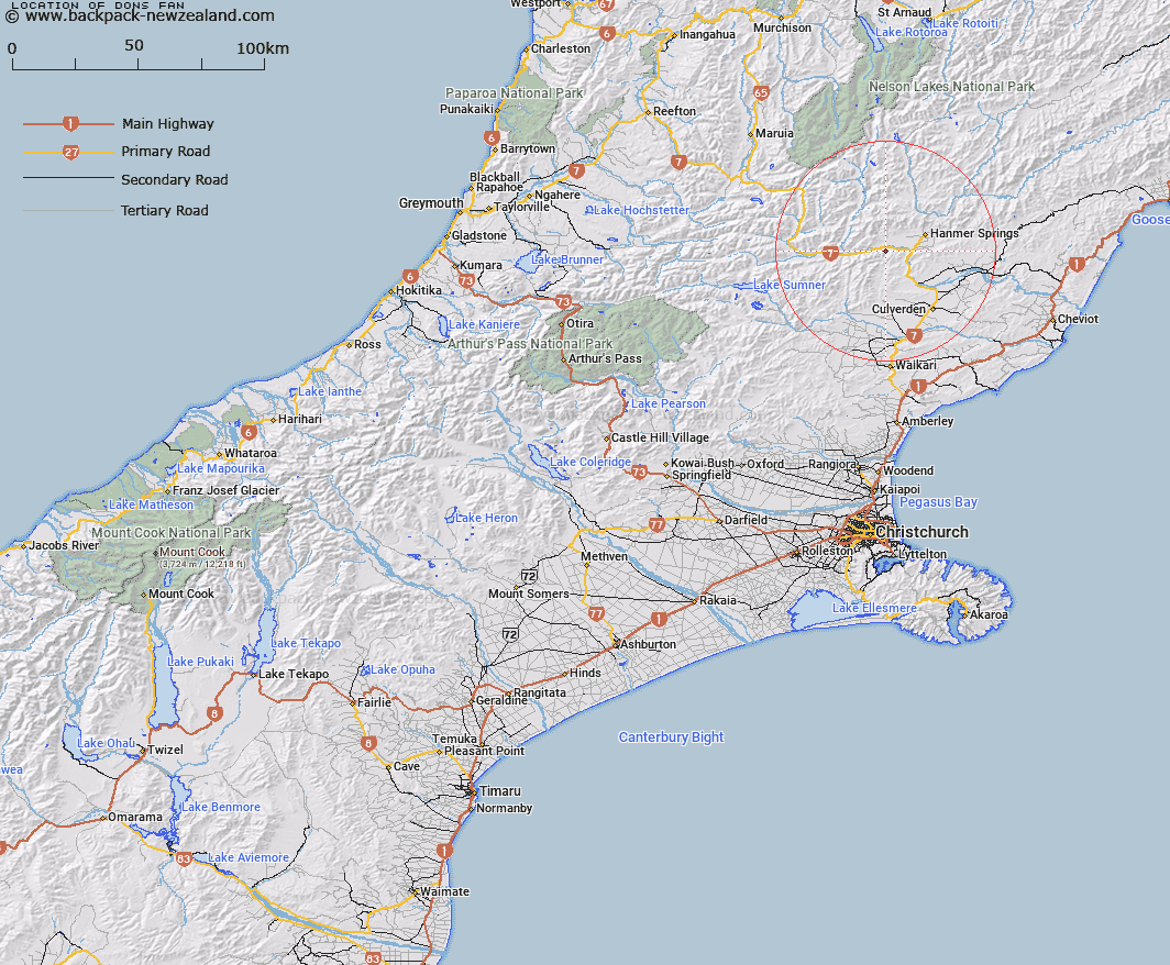
Map showing location of Dons Fan


LINZ description: A stream feature at 46miles 70chains from Waipara Flows north into Waiau River opposite Grantham River
Latitude: -42.580515
Longitude: 172.691485
Northing: 5285720.5
Easting: 1574683.1
Land District: Canterbury
Feat Type: Stream


Scroll down to see a more detailed road map and below that a topographical map showing the location of Dons Fan. The road map has been supplied by openstreetmap and the topographical map of Dons Fan has been supplied by Land Information New Zealand (LINZ).

Yes you can use the top static map for you school/university project or personal website with a link back. Contact me for any commercial use.

Dons Fan Map New Zealand


New Zealand places in our database
[ A ] [ B ] [ C ] [ D ] [ E ] [ F ] [ G ] [ H ] [ I ] [ J ] [ K ] [ L ] [ M ] [ N ] [ O ] [ P ] [ Q ] [ R ] [ S ] [ T ] [ U ] [ V ] [ W ] [ X ] [ Y ] [ Z ]


Closest 20 Streams to Dons Fan

Haliwai Stream ( 0.92km )   Dorns Stream ( 1.83km )   Handyside Stream ( 1.83km )   Waterfall Stream ( 2.77km )   Handyside Stream ( 2.77km )   Camp Stream ( 3.76km )   Empson River ( 4.52km )   Greenstone Stream ( 4.53km )   Ship Spur Stream ( 4.53km )   Shale Peak Stream ( 4.57km )   Boundary Stream ( 4.57km )   Grantham River ( 4.84km )   Ribbon Stream ( 5.93km )   Boundary Stream ( 6.03km )   Deep Stream ( 6.03km )   Glenallan Stream ( 6.18km )   Waiau Uwha River ( 6.73km )   Waiau River ( 6.73km )   Tutu Stream ( 7.7km )   Percival River ( 8.08km )   William Stream ( 8.15km )   Cow Stream ( 8.15km )   Twenty One Mile Stream ( 8.45km )   Camp Creek ( 8.68km )   Rogerson River ( 9.01km )   Calf Creek ( 9.27km )   Glenartney Stream ( 9.36km )   Broom Stream ( 9.7km )   Sweetwater Stream ( 9.71km )   Browns stream ( 10.1km )   Chatterton River ( 10.37km )   Te Kooti Stream ( 10.64km )   Boko Stream ( 11.12km )   Retreat Stream ( 11.34km )   Leslie Stream ( 11.94km )   Duck Stream ( 11.99km )   Castle Stream ( 12.29km )   Dillons Stream ( 12.33km )   Gorge Stream ( 12.41km )   Stinking Stream ( 12.51km )