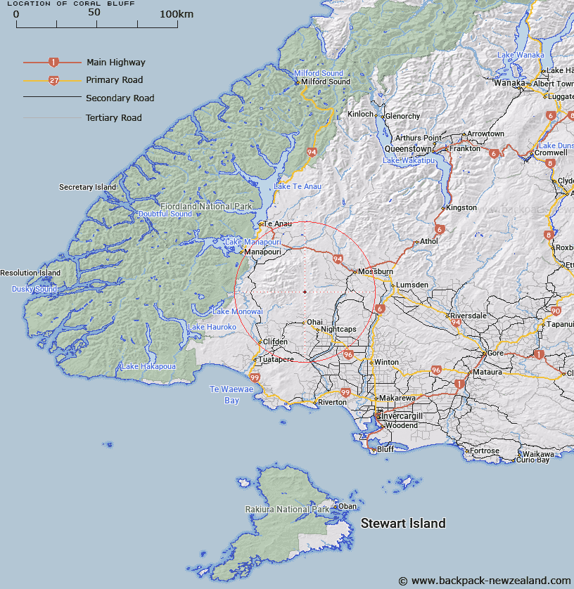
Map showing location of Coral Bluff


LINZ description: Approximately one mile north-west of Letham Hill. Wairaki Survey District.
Latitude: -45.769549
Longitude: 167.961784
Northing: 4919200
Easting: 1208276.2
Land District: Southland
Feat Type: Cliff


Scroll down to see a more detailed road map and below that a topographical map showing the location of Coral Bluff. The road map has been supplied by openstreetmap and the topographical map of Coral Bluff has been supplied by Land Information New Zealand (LINZ).

Yes you can use the top static map for you school/university project or personal website with a link back. Contact me for any commercial use.

Coral Bluff Map New Zealand


New Zealand places in our database
[ A ] [ B ] [ C ] [ D ] [ E ] [ F ] [ G ] [ H ] [ I ] [ J ] [ K ] [ L ] [ M ] [ N ] [ O ] [ P ] [ Q ] [ R ] [ S ] [ T ] [ U ] [ V ] [ W ] [ X ] [ Y ] [ Z ]


Closest 20 Cliffs to Coral Bluff

Braida Crags ( 27.79km )   Yellow Bluff ( 39.68km )   The Bluffs ( 53.09km )   Brighams Leap ( 72.48km )   Duncans Seat ( 78.57km )   Home Faces ( 79.76km )   McAlister Faces ( 82.34km )   Twelve Mile Bluff ( 87.44km )   Bennetts Bluff ( 90.36km )   Island Face ( 92.62km )   Echo Cliffs ( 94.69km )   The Redan ( 109.07km )   Pinchers Bluff ( 111.61km )   Maori Head ( 113.49km )   Nevis Bluff ( 114.9km )   Deadmans Bluff ( 115.41km )   White Cliffs ( 115.89km )   Arrow Face ( 117.28km )   Lovers Leap ( 120.69km )   McLeods Bluff ( 123.27km )   Gibraltar Rock ( 125.6km )   Molyneux Face ( 126.53km )   Chinamans Bluff ( 127.93km )   Lowburn Face ( 132.63km )   Jacobs Ladder ( 133.28km )   Sandy Bluff ( 135.59km )   Glendhu Bluff ( 147.7km )   Jerry Bluff ( 172.05km )   Gorge Bluff ( 176.67km )   Spectre Faces ( 178.26km )   Break Neck Face ( 178.58km )   Franklin Slopes ( 180.37km )   Sandrock Bluff ( 184.25km )   Watson Bluff ( 190.96km )   Halfway Bluff ( 192.82km )   Barn Bay Bluff ( 193.97km )   Iota Bluff ( 195.33km )   Wheeler Bluff ( 197.83km )   Pudneys Cliff ( 202.81km )   Presto Defile ( 203.28km )